

Topografische Karte Mount Yangtai
Klicken Sie auf die Karte, um die Höhe anzuzeigen.
Mount Yangtai
The Mount Yangtai (Chinese: 羊台山; pinyin: Yángtaíshān), also known as Mount Yangtai Forest Park, is a mountain at the junction of Bao'an District and Nanshan District in Shenzhen, Guangdong, China. The peak is 587.3 metres (1,927 ft) in elevation, which is the highest peak in western Shenzhen. In 2008 The mount is rated as one of the eight scenic spots of Shenzhen by the Shenzhen government.
Über diese Karte

Name: Topografische Karte Mount Yangtai, Höhe, Relief.
Ort: Mount Yangtai, Shenzhen, Guangdong, 518109, China (22.65439 113.95590 22.65449 113.95600)
Durchschnittliche Höhe: 287 m
Minimale Höhe: 45 m
Maximale Höhe: 557 m
Andere topografische Karten
Klicken Sie auf eine Karte, um ihre Topografie, ihre Höhe und ihr Relief anzuzeigen.

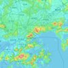
Nanshan District
At 587 metres (1,926 ft) tall, Yangtaishan has the highest elevation in the district, with Tanglangshan being the second at 430 metres (1,411 ft), and Nanshan, third, at 336 metres (1,102 ft). The district has a total coastline of 55.18 kilometres (34.29 mi).
Durchschnittliche Höhe: 40 m




Nanshan District
At 587 metres (1,926 ft) tall, Yangtaishan has the highest elevation in the district, with Tanglangshan being the second at 430 metres (1,411 ft), and Nanshan, third, at 336 metres (1,102 ft). The district has a total coastline of 55.18 kilometres (34.29 mi).
Durchschnittliche Höhe: 35 m