

Topografische Karte Magothy Forest
Klicken Sie auf die Karte, um die Höhe anzuzeigen.
Über diese Karte
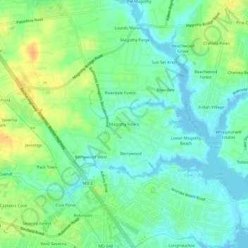
Name: Topografische Karte Magothy Forest, Höhe, Relief.
Durchschnittliche Höhe: 13 m
Minimale Höhe: -3 m
Maximale Höhe: 35 m
Andere topografische Karten
Klicken Sie auf eine Karte, um ihre Topografie, ihre Höhe und ihr Relief anzuzeigen.
Severna Park
United States > Maryland > Anne Arundel County > Severna Park
Durchschnittliche Höhe: 20 m
Magothy River
United States > Maryland > Anne Arundel County > Severna Park
Almost all of the creeks and tidal coves on the Magothy are named, partly as the result of a project started in 2001 by the Magothy River Association. They are shown on a map produced as part of that project, and the major ones are shown on the USGS topographic map.
Durchschnittliche Höhe: 9 m