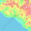
Topografische Karte Favara
Klicken Sie auf die Karte, um die Höhe anzuzeigen.
Favara
The town is located on the slope of a 533 m hill, Monte Caltafaraci, locally known as the Muntaggneḍḍa (little mountain in Sicilian). The average elevation is 338 m, with a minimum of 20 m and a maximum of 533 m. Favara is part of the agricultural region #5 Agrigento seaside hills (Italian: Colline litoranee di Agrigento). The local climate falls into the Csa category of the Köppen climate classification, i.e. a warm Mediterranean climate with hot and dry summers and temperate winters, with temperature rarely dropping below 0 °C.
Über diese Karte

Name: Topografische Karte Favara, Höhe, Relief.
Ort: Favara, Agrigento, Sicily, 92026, Italy (37.23900 13.60961 37.39129 13.73651)
Durchschnittliche Höhe: 254 m
Minimale Höhe: 0 m
Maximale Höhe: 558 m
Andere topografische Karten
Klicken Sie auf eine Karte, um ihre Topografie, ihre Höhe und ihr Relief anzuzeigen.