
Topografische Karte Karer See - Lago di Carezza
Interaktive Karte
Klicken Sie auf die Karte, um die Höhe anzuzeigen.
Über diese Karte
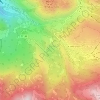
Name: Topografische Karte Karer See - Lago di Carezza, Höhe, Relief.
Durchschnittliche Höhe: 1’606 m
Minimale Höhe: 1’223 m
Maximale Höhe: 1’950 m
The lake is located in the western Dolomites on the edge of the Latemarwald, just 20 kilometers southeast of Bolzano at 1520 m altitude in the municipality Welschnofen. The nearest settlement is Carezza. The roughly 300 m long and 140 m wide stretch of water is fed by underground springs from the Latemar mountain range.