

Topografische Karte Grassano
Klicken Sie auf die Karte, um die Höhe anzuzeigen.
Grassano
Grassano is a town and comune in the province of Matera, in the southern Italian region of Basilicata. It is located between the Bradano and Basento rivers at an elevation ranging from about 150 to 576 metres (492 to 1,890 ft) above sea level. The town proper is 43 kilometres (27 mi) from Matera and 59 kilometres (37 mi) from the regional capital, Potenza.
Über diese Karte
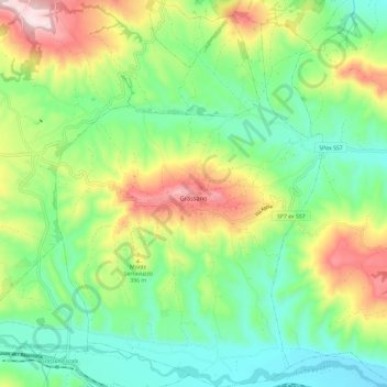
Name: Topografische Karte Grassano, Höhe, Relief.
Ort: Grassano, Matera, Basilicata, 75014, Italy (40.58874 16.24061 40.67866 16.32242)
Durchschnittliche Höhe: 297 m
Minimale Höhe: 135 m
Maximale Höhe: 603 m
Andere topografische Karten
Klicken Sie auf eine Karte, um ihre Topografie, ihre Höhe und ihr Relief anzuzeigen.


