
Topografische Karte 'Amanave
Interaktive Karte
Klicken Sie auf die Karte, um die Höhe anzuzeigen.
Über diese Karte
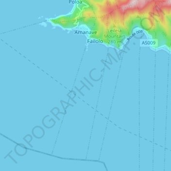
Name: Topografische Karte 'Amanave, Höhe, Relief.
Durchschnittliche Höhe: 23 m
Minimale Höhe: 0 m
Maximale Höhe: 372 m
'Amanave was severely damaged by the 2009 tsunami. However, of a population of about 500 residents, no deaths were recorded. When the tsunami approached, emergency information was sent by radio and a bell rang in the village. After the tsunami, some residents followed the advice of the Federal Emergency Management Agency (FEMA) and moved into houses on a higher elevation.