
Topografische Karte Santa Barbara
Interaktive Karte
Klicken Sie auf die Karte, um die Höhe anzuzeigen.
Über diese Karte
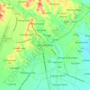
Name: Topografische Karte Santa Barbara, Höhe, Relief.
Ort: Santa Barbara, Iloilo, Western Visayas, 5002, Philippines (10.78723 122.49147 10.86723 122.57147)
Durchschnittliche Höhe: 34 m
Minimale Höhe: 10 m
Maximale Höhe: 79 m
The topography of Santa Barbara varies from slightly rolling hills to almost flat or gradually inclined plains, sliced by Tigum River at its centremost, which flows from the north-west to the southeast and the Aganan River in the southern section.