
Topografische Karte Boogertown
Interaktive Karte
Klicken Sie auf die Karte, um die Höhe anzuzeigen.
Über diese Karte
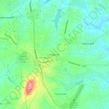
Name: Topografische Karte Boogertown, Höhe, Relief.
Durchschnittliche Höhe: 236 m
Minimale Höhe: 203 m
Maximale Höhe: 316 m
Andere topografische Karten
Klicken Sie auf eine Karte, um ihre Topografie, ihre Höhe und ihr Relief anzuzeigen.
Crowders Mountain
United States > North Carolina > Gaston County > Gastonia
Crowders Mountain, Gastonia, Gaston County, North Carolina, United States
Durchschnittliche Höhe: 284 m
Gastonia
United States > North Carolina > Gaston County > Gastonia > Gastonia
Gastonia, Gaston County, North Carolina, 28054, United States
Durchschnittliche Höhe: 234 m