
Topografische Karte Sempringham
Klicken Sie auf die Karte, um die Höhe anzuzeigen.
Sempringham
Sempringham consists of a church and a holy well, with other houses east from the church scattered along the B1177 between Pointon and Billingborough. The church stands at an altitude of about 52 feet (16 m), on land rising out of flat fenland. Pointon is the chief township of the civil parish, which includes Millthorpe and the fens of Pointon, Neslam and Aslackby, and a part of Hundred Fen at Gosberton Clough. Formerly, Birthorpe, now part of Billingborough, was included in the parish.
Über diese Karte
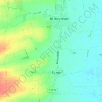
Name: Topografische Karte Sempringham, Höhe, Relief.
Durchschnittliche Höhe: 16 m
Minimale Höhe: 1 m
Maximale Höhe: 50 m