
Topografische Karte Bannister
Interaktive Karte
Klicken Sie auf die Karte, um die Höhe anzuzeigen.
Über diese Karte
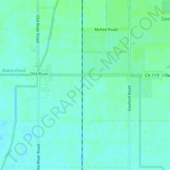
Name: Topografische Karte Bannister, Höhe, Relief.
Ort: Bannister, Kern County, California, 93313, United States (35.25552 -119.11066 35.27552 -119.09066)
Durchschnittliche Höhe: 104 m
Minimale Höhe: 100 m
Maximale Höhe: 108 m
Andere topografische Karten
Klicken Sie auf eine Karte, um ihre Topografie, ihre Höhe und ihr Relief anzuzeigen.
Pentland
United States > California > Kern County
Pentland, Kern County, California, United States
Durchschnittliche Höhe: 198 m
Rosedale
United States > California > Kern County
Rosedale, Kern County, CAL Fire Contract Counties, California, United States
Durchschnittliche Höhe: 107 m
Tehachapi
United States > California > Kern County
Tehachapi, Kern County, California, 93561, United States
Durchschnittliche Höhe: 1’414 m
Brown
United States > California > Kern County
Brown, Kern County, California, United States
Durchschnittliche Höhe: 732 m
Mount Adelaide
United States > California > Kern County
Mount Adelaide, Kern County, California, United States
Durchschnittliche Höhe: 841 m
Rosedale
United States > California > Kern County
Rosedale, Kern County, California, United States
Durchschnittliche Höhe: 113 m