
Topografische Karte Tawang
Interaktive Karte
Klicken Sie auf die Karte, um die Höhe anzuzeigen.
Über diese Karte
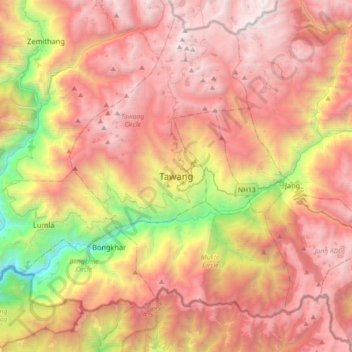
Name: Topografische Karte Tawang, Höhe, Relief.
Durchschnittliche Höhe: 3’280 m
Minimale Höhe: 1’170 m
Maximale Höhe: 4’913 m
Tawang is situated 448 km north-west of state capital Itanagar at an elevation of approximately 3,048 metres (10,000 ft). It lies to the north of the Tawang Chu river valley, roughly 10 miles (16 km) south of the Line of Actual Control with China. It is the site of a famous Gelugpa Buddhist monastery.
Andere topografische Karten
Klicken Sie auf eine Karte, um ihre Topografie, ihre Höhe und ihr Relief anzuzeigen.
Bum La
India > Arunachal Pradesh > Tawang Circle
Bum La, Tawang Circle, Tawang District, Arunachal Pradesh, India
Durchschnittliche Höhe: 4’484 m