
Topografische Karte Oil Center
Interaktive Karte
Klicken Sie auf die Karte, um die Höhe anzuzeigen.
Über diese Karte
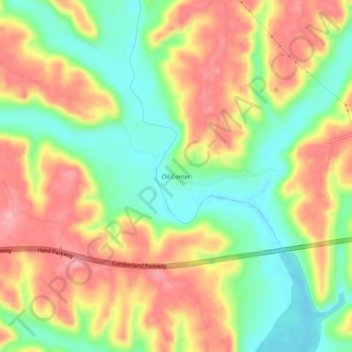
Name: Topografische Karte Oil Center, Höhe, Relief.
Ort: Oil Center, Pulaski County, Kentucky, United States (37.08591 -84.72689 37.12591 -84.68689)
Durchschnittliche Höhe: 268 m
Minimale Höhe: 210 m
Maximale Höhe: 325 m
Andere topografische Karten
Klicken Sie auf eine Karte, um ihre Topografie, ihre Höhe und ihr Relief anzuzeigen.
Somerset
United States > Kentucky > Pulaski County
Somerset, Pulaski County, Kentucky, 42503, United States
Durchschnittliche Höhe: 295 m
Sinking Valley
United States > Kentucky > Pulaski County
Sinking Valley, Pulaski County, Kentucky, United States
Durchschnittliche Höhe: 309 m
Eubank
United States > Kentucky > Pulaski County
Eubank, Pulaski County, Kentucky, United States
Durchschnittliche Höhe: 354 m
Burnside
United States > Kentucky > Pulaski County
Burnside, Pulaski County, Kentucky, United States
Durchschnittliche Höhe: 251 m
Science Hill
United States > Kentucky > Pulaski County
Science Hill, Pulaski County, Kentucky, United States
Durchschnittliche Höhe: 327 m
Elrod
United States > Kentucky > Pulaski County > Elrod
Elrod, Pulaski County, Kentucky, United States
Durchschnittliche Höhe: 298 m
Keno
United States > Kentucky > Pulaski County
Keno, Pulaski County, Kentucky, United States
Durchschnittliche Höhe: 308 m