
Topografische Karte Singa
Interaktive Karte
Klicken Sie auf die Karte, um die Höhe anzuzeigen.
Über diese Karte
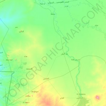
Name: Topografische Karte Singa, Höhe, Relief.
Ort: Singa, Sennar State, Sudan (11.67454 33.08204 13.36110 34.34233)
Durchschnittliche Höhe: 462 m
Minimale Höhe: 400 m
Maximale Höhe: 785 m
Singa (Arabic: سنجة) is a town located in the Sennar State of Sudan at an elevation of 439 meters (1,440 feet) above sea level. The town is situated on the west bank of the Blue Nile at a distance of 360 kilometers (220 miles) to the southeast of the capital, Khartoum, and 60 kilometers from Sennar city. Its population was recorded to be 259,000 in 2002.
Andere topografische Karten
Klicken Sie auf eine Karte, um ihre Topografie, ihre Höhe und ihr Relief anzuzeigen.
Jalqani
Sudan > Sennar State > Ad Dinder
Jalqani, Ad Dinder, Sennar State, Sudan
Durchschnittliche Höhe: 450 m