
Topografische Karte Kargil
Klicken Sie auf die Karte, um die Höhe anzuzeigen.
Kargil
Kargil has an average elevation of 2,676 metres (8,780 feet), and is situated along the banks of the Suru River (Indus). The town of Kargil is located 205 km (127 mi) from Srinagar, facing the Northern Areas across the LOC. Like other areas in the Himalayas, Kargil has a temperate climate. Summers are hot with cool nights, while winters are long and chilly with temperatures often dropping below −20 °C (−4 °F).
Über diese Karte
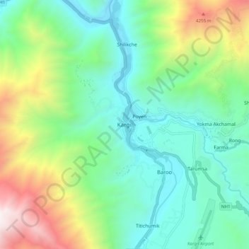
Name: Topografische Karte Kargil, Höhe, Relief.
Ort: Kargil, Kargil Tehsil, Kargil district, Ladakh, 194103, India (34.51930 76.08558 34.59930 76.16558)
Durchschnittliche Höhe: 3’262 m
Minimale Höhe: 2’613 m
Maximale Höhe: 4’847 m