

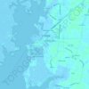
Topografische Karte Westover
Klicken Sie auf die Karte, um die Höhe anzuzeigen.
Über diese Karte

Name: Topografische Karte Westover, Höhe, Relief.
Ort: Westover, Somerset County, Maryland, 21890, United States (38.10401 -75.72632 38.14401 -75.68632)
Durchschnittliche Höhe: 4 m
Minimale Höhe: -3 m
Maximale Höhe: 8 m
Andere topografische Karten
Klicken Sie auf eine Karte, um ihre Topografie, ihre Höhe und ihr Relief anzuzeigen.
Crisfield
United States > Maryland > Somerset County
Crisfield is a very compact city, with little vacant land. According to the United States Census Bureau, the city has a total area of 3.06 square miles (7.93 km2), of which 1.62 square miles (4.20 km2) (53.0%) is land and 1.44 square miles (3.73 km2) (47.0%) is water. As one of the southern points on the…
Durchschnittliche Höhe: 1 m