
Topografische Karte Wieżyca
Interaktive Karte
Klicken Sie auf die Karte, um die Höhe anzuzeigen.
Wieżyca
Wieżyca (Kashubian Wieżëca, German Turmberg) is a hill located in northern Poland, in the historical region of Kashubia, some 40 kilometers southwest of Gdańsk. With elevation of 329 metres above sea level, it is the highest peak of central and northern Poland. Its top is covered by a forest, and the hill was the object of pagan cult of ancient Slavs. Wieżyca is a popular tourist area, with a ski lift and a ski slope.
Über diese Karte
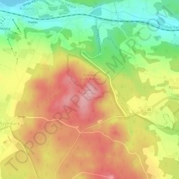
Name: Topografische Karte Wieżyca, Höhe, Relief.
Durchschnittliche Höhe: 247 m
Minimale Höhe: 162 m
Maximale Höhe: 325 m