
Topografische Karte O'Kean
Interaktive Karte
Klicken Sie auf die Karte, um die Höhe anzuzeigen.
Über diese Karte
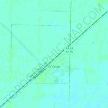
Name: Topografische Karte O'Kean, Höhe, Relief.
Ort: O'Kean, Randolph County, Arkansas, 72425, United States (36.16416 -90.82752 36.17893 -90.80908)
Durchschnittliche Höhe: 82 m
Minimale Höhe: 79 m
Maximale Höhe: 85 m
Andere topografische Karten
Klicken Sie auf eine Karte, um ihre Topografie, ihre Höhe und ihr Relief anzuzeigen.
Sand Hill
United States > Arkansas > Randolph County > Pocahontas
Sand Hill, Pocahontas, Randolph County, Arkansas, 72455, United States
Durchschnittliche Höhe: 118 m
Maynard
United States > Arkansas > Randolph County
Maynard, Randolph County, Arkansas, 72444, United States
Durchschnittliche Höhe: 128 m
Warm Springs
United States > Arkansas > Randolph County
Warm Springs, Randolph County, Arkansas, 72478, United States
Durchschnittliche Höhe: 148 m
Pocahontas
United States > Arkansas > Randolph County > Pocahontas
Pocahontas, Randolph County, Arkansas, United States
Durchschnittliche Höhe: 96 m
Pocahontas
United States > Arkansas > Randolph County > Pocahontas
Pocahontas, Randolph County, Arkansas, 72455, United States
Durchschnittliche Höhe: 94 m
O"Kean
United States > Arkansas > Randolph County > O"Kean
O"Kean, Randolph County, Arkansas, 72425, United States
Durchschnittliche Höhe: 82 m