Geolokalisieren

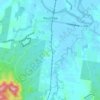
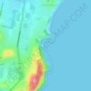
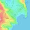
Topografische Karte Buchan Point

Klicken Sie auf die Karte, um die Höhe anzuzeigen.

Über diese Karte

Name: Topografische Karte Buchan Point, Höhe, Relief.

Ort: Buchan Point, New South Wales, 2036, Australia (-33.97803 151.25570 -33.97793 151.25580)

Durchschnittliche Höhe: 15 m

Minimale Höhe: -1 m

Maximale Höhe: 50 m

Andere topografische Karten

Klicken Sie auf eine Karte, um ihre Topografie, ihre Höhe und ihr Relief anzuzeigen.
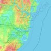
Sydney

Australia > New South Wales

Sydney's topography is characterized by a diverse landscape that seamlessly blends coastal features with inland plateaus. The city is divided into two primary regions: the relatively flat Cumberland Plain to the south and west of Sydney Harbour, and the elevated Hornsby Plateau to the north. The Cumberland…

Durchschnittliche Höhe: 51 m

Karangi

Australia > New South Wales

Durchschnittliche Höhe: 173 m

Barrington Tops

Australia > New South Wales

Durchschnittliche Höhe: 1’107 m

Kosciuszko National Park

Australia > New South Wales

Durchschnittliche Höhe: 883 m

Wentworth Falls

Australia > New South Wales > Sydney

Wentworth Falls (postcode: 2782) is a town in the Blue Mountains region of New South Wales, situated approximately 100 kilometres (62 mi) west of the Sydney central business district, and about 8 kilometres (5.0 mi) east of Katoomba, Australia on the Great Western Highway, with a Wentworth Falls railway…

Durchschnittliche Höhe: 708 m
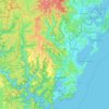
Central Coast Council

Australia > New South Wales

Durchschnittliche Höhe: 103 m

Penrith

Australia > New South Wales > Sydney > Penrith

Penrith is a city in New South Wales, Australia, located in Greater Western Sydney, 55 kilometres (31 mi) west of the Sydney central business district on the banks of the Nepean River, on the outskirts of the Cumberland Plain. Its elevation is 32 metres (105 ft).

Durchschnittliche Höhe: 34 m

Lismore

Australia > New South Wales

Durchschnittliche Höhe: 23 m

Newcastle

Australia > New South Wales > Newcastle

Durchschnittliche Höhe: 5 m

Moruya Heads

Australia > New South Wales

Durchschnittliche Höhe: 9 m

Katoomba

Australia > New South Wales

Durchschnittliche Höhe: 904 m

St Ives

Australia > New South Wales > Sydney

Durchschnittliche Höhe: 125 m

Mudgee

Australia > New South Wales

Durchschnittliche Höhe: 535 m

Wauchope

Australia > New South Wales

Durchschnittliche Höhe: 32 m

Sydney

Australia > New South Wales > Sydney

Durchschnittliche Höhe: 23 m

Burramoko Ridge

Australia > New South Wales

Durchschnittliche Höhe: 920 m

Parramatta

Australia > New South Wales

Durchschnittliche Höhe: 22 m

Newcastle City Council

Australia > New South Wales

Durchschnittliche Höhe: 18 m

Moruya

Australia > New South Wales

Durchschnittliche Höhe: 37 m

Scotts Head

Australia > New South Wales

Durchschnittliche Höhe: 5 m

Dubbo

Australia > New South Wales

Durchschnittliche Höhe: 318 m

Akolele

Australia > New South Wales

Durchschnittliche Höhe: 15 m

Lismore City Council

Australia > New South Wales

Durchschnittliche Höhe: 83 m

Port Macquarie

Australia > New South Wales

Durchschnittliche Höhe: 5 m

Muswellbrook Shire Council

Australia > New South Wales

Durchschnittliche Höhe: 397 m

Windsor

Australia > New South Wales

Durchschnittliche Höhe: 12 m

Laurel Hill

Australia > New South Wales

Durchschnittliche Höhe: 990 m

Tyalgum Creek

Australia > New South Wales

Durchschnittliche Höhe: 346 m

Orange

Australia > New South Wales

Orange is a city in the Central Tablelands region of New South Wales, Australia. It is 254 km (158 mi) west of the state capital, Sydney [206 km (128 mi) on a great circle], at an altitude of 862 metres (2,828 ft). Orange had an estimated urban population of 40,493 as of June 2018 making the city a significant…

Durchschnittliche Höhe: 852 m

Carabost

Australia > New South Wales

Durchschnittliche Höhe: 484 m

Nobbys Creek

Australia > New South Wales

Durchschnittliche Höhe: 66 m

Bents Basin State Conservation Area

Australia > New South Wales > Sydney

The park is popular for swimming, kayaking, bushwalking, camping (with 100 tent sites), barbecuing, picnicking and fishing. The park also features walking trails within a bushland and an education centre with a commercial kitchen. Caley's Lookout Track, a walking track within the bushland, leads to Little…

Durchschnittliche Höhe: 82 m

Oallen

Australia > New South Wales

Durchschnittliche Höhe: 593 m

Armidale

Australia > New South Wales

Durchschnittliche Höhe: 1’036 m

Alstonville

Australia > New South Wales

Durchschnittliche Höhe: 131 m

Chatswood

Australia > New South Wales

Durchschnittliche Höhe: 81 m

Woolgoolga

Australia > New South Wales

Durchschnittliche Höhe: 29 m

Bateau Bay

Australia > New South Wales > Gosford

Durchschnittliche Höhe: 16 m

Caves Beach

Australia > New South Wales

Durchschnittliche Höhe: 22 m

Gulmarrad

Australia > New South Wales

Durchschnittliche Höhe: 10 m

Bega Valley Shire Council

Australia > New South Wales

Durchschnittliche Höhe: 370 m

Bonalbo

Australia > New South Wales

Durchschnittliche Höhe: 263 m

Carcoar

Australia > New South Wales

Durchschnittliche Höhe: 818 m

Northern Beaches

Australia > New South Wales > Sydney

Durchschnittliche Höhe: 67 m

Werri Beach

Australia > New South Wales

Durchschnittliche Höhe: 9 m

Pooncarie

Australia > New South Wales > Pooncarie

Durchschnittliche Höhe: 68 m

Ulong

Australia > New South Wales

Durchschnittliche Höhe: 559 m

Fingal Bay

Australia > New South Wales

Durchschnittliche Höhe: 13 m

Bargo

Australia > New South Wales

Durchschnittliche Höhe: 346 m

Yass

Australia > New South Wales

Yass is located 280 km south-west of Sydney, on the Hume Highway. The Yass River, which is a tributary of the Murrumbidgee River, flows through the town. Yass is 59 km from Canberra; lying at an elevation of 505 m AMSL.

Durchschnittliche Höhe: 533 m
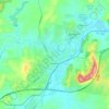
Goulburn

Australia > New South Wales

Owing to its elevation, Goulburn has an oceanic climate (Cfb) with warm summers and cool winters; with a high diurnal range. Its climate is variable much of the year, though generally dry with maximum temperatures ranging from 11.8 °C (53.2 °F) in July to 28.3 °C (82.9 °F) in January. Rainfall is…

Durchschnittliche Höhe: 666 m
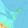
Byron Bay

Australia > New South Wales

Byron Bay, located in northeastern New South Wales, Australia, is characterized by diverse topography shaped by its geological history. The town is part of the erosion caldera of the ancient Tweed Volcano, which erupted approximately 23 million years ago, resulting in the rich volcanic soils that define the…

Durchschnittliche Höhe: 7 m
Lithgow City Council

Australia > New South Wales

Durchschnittliche Höhe: 713 m

Sutherland Shire Council

Australia > New South Wales > Sydney

Durchschnittliche Höhe: 79 m

Asquith

Australia > New South Wales

Durchschnittliche Höhe: 168 m

Swan Bay

Australia > New South Wales

Durchschnittliche Höhe: 5 m

Edensor Park

Australia > New South Wales > Sydney

Durchschnittliche Höhe: 57 m

Bowral

Australia > New South Wales

Durchschnittliche Höhe: 690 m

Leichhardt

Australia > New South Wales > Sydney

Durchschnittliche Höhe: 22 m

Fairfield City Council

Australia > New South Wales > Sydney

Durchschnittliche Höhe: 50 m

Blackheath

Australia > New South Wales

Blackheath (postcode: 2785) is an Australian town located near the highest point of the Blue Mountains, between Katoomba and Mount Victoria in New South Wales. The town's altitude is about 1,065 metres (3,494 ft) AHD  and it is located about 120 kilometres (75 mi) west north-west of Sydney, 11 kilometres…

Durchschnittliche Höhe: 893 m

Glenfield

Australia > New South Wales > Sydney

Durchschnittliche Höhe: 29 m

Roseville

Australia > New South Wales > Sydney

Durchschnittliche Höhe: 84 m

Wollongbar

Australia > New South Wales

Durchschnittliche Höhe: 134 m

Allambie Heights

Australia > New South Wales > Sydney

Durchschnittliche Höhe: 77 m

Glenorie

Australia > New South Wales

Durchschnittliche Höhe: 131 m

Wollemi National Park

Australia > New South Wales

Durchschnittliche Höhe: 521 m

Thornleigh

Australia > New South Wales > Sydney

Thornleigh is bounded to the north by Waitara Creek and south by the Lane Cove National Park. Thornleigh borders the suburbs of Normanhurst, Hornsby, Wahroonga, Westleigh and Pennant Hills. Thornleigh offers great district views, and the topography varies greatly with many established areas built around…

Durchschnittliche Höhe: 159 m

Kiama

Australia > New South Wales

Durchschnittliche Höhe: 29 m

Kingsford

Australia > New South Wales > Sydney

Durchschnittliche Höhe: 32 m

Gosford

Australia > New South Wales > Gosford

Durchschnittliche Höhe: 25 m

Stockton

Australia > New South Wales > Newcastle

Durchschnittliche Höhe: 2 m

Charlestown

Australia > New South Wales

Durchschnittliche Höhe: 71 m

Bondi Beach

Australia > New South Wales > Sydney

Durchschnittliche Höhe: 31 m

Kangaroo Valley

Australia > New South Wales

Durchschnittliche Höhe: 320 m

Batehaven

Australia > New South Wales

Durchschnittliche Höhe: 16 m

Merewether

Australia > New South Wales > Newcastle

Durchschnittliche Höhe: 23 m

Sutherland Shire

Australia > New South Wales > Sydney

Durchschnittliche Höhe: 79 m

Fern Bay

Australia > New South Wales > Newcastle

Durchschnittliche Höhe: 4 m

Booral

Australia > New South Wales

Durchschnittliche Höhe: 98 m

Coffs Harbour

Australia > New South Wales > Coffs Harbour

Durchschnittliche Höhe: 32 m

Four Mile Creek

Australia > New South Wales

Durchschnittliche Höhe: 831 m

Goonengerry

Australia > New South Wales

Durchschnittliche Höhe: 152 m

Old Adaminaby

Australia > New South Wales

Durchschnittliche Höhe: 1’172 m

Emu Heights

Australia > New South Wales > Sydney

Durchschnittliche Höhe: 87 m

Tahmoor

Australia > New South Wales

Durchschnittliche Höhe: 269 m

Mullumbimby

Australia > New South Wales

Durchschnittliche Höhe: 29 m

Manly

Australia > New South Wales

Durchschnittliche Höhe: 17 m

Moree

Australia > New South Wales

Durchschnittliche Höhe: 216 m

Robertson

Australia > New South Wales

Durchschnittliche Höhe: 545 m

Perisher Valley

Australia > New South Wales

Durchschnittliche Höhe: 1’704 m

Bossley Park

Australia > New South Wales

Durchschnittliche Höhe: 55 m

Nimbin

Australia > New South Wales

Durchschnittliche Höhe: 235 m

Ocean Shores

Australia > New South Wales

Durchschnittliche Höhe: 12 m

North Rothbury

Australia > New South Wales

Durchschnittliche Höhe: 66 m

Tweed Shire Council

Australia > New South Wales

Durchschnittliche Höhe: 212 m

Banora Point

Australia > New South Wales

Durchschnittliche Höhe: 17 m

Eurobodalla Shire Council

Australia > New South Wales

Durchschnittliche Höhe: 380 m

Nelson Bay

Australia > New South Wales

Durchschnittliche Höhe: 23 m

Castle Hill

Australia > New South Wales

Durchschnittliche Höhe: 123 m

Rüste dich für dein nächstes Abenteuer:

🔋Akkus & Ladeadapter - Ersatz‑ und Zusatzakkus für unterwegs
🧼Schuhpflege‑Sets - Pflege für langlebige Wander‑ und Outdoor‑Schuhe
👒Sonnenhüte - Rundum-Schutz vor intensiver Bergsonne
🧯Feuerstarter & Zündmittel - Zuverlässige Methoden zum Feuer machen draußen
🧥Leichte Regenjacken - Minimales Packmass bei maximalem Schutz vor Regenschauern

Als Amazon-Partner verdient diese Seite an qualifizierten Käufen, ohne dass Ihnen zusätzliche Kosten entstehen.