Geolokalisieren

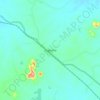
Topografische Karte Sukma

Klicken Sie auf die Karte, um die Höhe anzuzeigen.

Sukma

This place can easily be a matter of research for the Archaeological department as there exists rare ancient sculptures in this area, one can see a sculpture on which Brahma, Vishnu and Mahesh the Trinity of Hindu faith can be seen on a single stone. Now with the elevation of this area into a new District people are hopeful that Archaeological department will start researching in this area and unveil the historical importance of the land to the outer world.

Wikipedia (CC-BY-SA 3.0)

Über diese Karte

Name: Topografische Karte Sukma, Höhe, Relief.

Ort: Sukma, Chhattisgarh, India (17.78222 80.91126 18.77433 81.96794)

Durchschnittliche Höhe: 256 m

Minimale Höhe: 31 m

Maximale Höhe: 1’340 m

Andere topografische Karten

Klicken Sie auf eine Karte, um ihre Topografie, ihre Höhe und ihr Relief anzuzeigen.

Bishrampur

India > Chhattisgarh > Surajpur Tahsil

Durchschnittliche Höhe: 541 m

Kawardha

India > Chhattisgarh > Kawardha Tahsil

Kawardha is located at 22°01′N 81°15′E / 22.02°N 81.25°E / 22.02; 81.25. The total area is 798 square miles (2,070 km2). The state consists of hills and forests. It has an average elevation of 353 metres (1,158 ft).

Durchschnittliche Höhe: 350 m

Dhamtari

India > Chhattisgarh > Dhamtari Tahsil > Dhamtari

Durchschnittliche Höhe: 322 m

Atal Nagar-Nava Raipur

India > Chhattisgarh > Arang Tahsil

Durchschnittliche Höhe: 305 m

Kirandul

India > Chhattisgarh > Kuakonda Tahsil

The Kothavalasa–Kirandul line of East Coast Railway from Kirandul to Visakhapatnam via Koraput is laid through the Eastern Ghats. Up to Araku station, it has many tunnels. Also it pass through the highest elevation Broad gauge station in the Eastern ghats, Semiliguda, just before the Borra caves. Kirandul -…

Durchschnittliche Höhe: 742 m

Manendragarh

India > Chhattisgarh > Manendragarh Tahsil

Durchschnittliche Höhe: 489 m

Abhanpur

India > Chhattisgarh > Abhanpur Tahsil

Durchschnittliche Höhe: 319 m

Guru Ghasidas National Park

India > Chhattisgarh > Sonhat Tahsil

Durchschnittliche Höhe: 551 m

Saraipali

India > Chhattisgarh > Saraipali Tahsil

Durchschnittliche Höhe: 259 m

Chilpi

India > Chhattisgarh > Bodla Tahsil

Durchschnittliche Höhe: 822 m

Katghora

India > Chhattisgarh > Katghora Tahsil

Durchschnittliche Höhe: 331 m

Bagbahra

India > Chhattisgarh > Bagbahra Tahsil

Durchschnittliche Höhe: 347 m

Bhairamgarh

India > Chhattisgarh > Bijapur

Durchschnittliche Höhe: 333 m

Raigarh

India > Chhattisgarh

Durchschnittliche Höhe: 479 m

Raigarh

India > Chhattisgarh > Raigarh Tahsil

Raigarh is located at 21°54′N 83°24′E / 21.9°N 83.4°E / 21.9; 83.4. It has an average elevation of 215 metres (705 feet). The Kelo river flows through the city, which is one of its main water sources.

Durchschnittliche Höhe: 216 m

Surguja

India > Chhattisgarh

Durchschnittliche Höhe: 574 m

Jashpur Nagar

India > Chhattisgarh > Jashpur Tahsil

Durchschnittliche Höhe: 789 m

Balodabazar

India > Chhattisgarh > Baloda Bazar Tahsil

Baloda Bazar is located at 30°40′N 82°10′E / 30.67°N 82.17°E / 30.67; 82.17. It has an average elevation of 254 m (833 ft). There are several tourist places in Balodabazaar like Sirpur, Turturia, Giroudpuri, Siddheswr Mandir Pallari and many more.

Durchschnittliche Höhe: 251 m

Rajim

India > Chhattisgarh > Rajim Tahsil

It is located at an elevation of 281 m above MSL.

Durchschnittliche Höhe: 286 m

Katekalyan

India > Chhattisgarh > Bastanar Tahsil

Durchschnittliche Höhe: 595 m

Lakhanpur

India > Chhattisgarh > Lakhanpur Tahsil

Durchschnittliche Höhe: 582 m

Basna

India > Chhattisgarh > Basna Tahsil

Durchschnittliche Höhe: 268 m

Kurud

India > Chhattisgarh > Kurud Tahsil

Durchschnittliche Höhe: 310 m

Balrampur

India > Chhattisgarh > Balrampur Tahsil

Durchschnittliche Höhe: 535 m

Tulsi

India > Chhattisgarh > Nawagarh Tahsil

Durchschnittliche Höhe: 238 m

Seorinarayan

India > Chhattisgarh > Nawagarh Tahsil

Durchschnittliche Höhe: 226 m

Pasan

India > Chhattisgarh > Poundi-Uproda Tahsil

Durchschnittliche Höhe: 528 m

Magarlod

India > Chhattisgarh > Magarlod Tahsil

Durchschnittliche Höhe: 314 m

Pathalgaon

India > Chhattisgarh > Pathalgaon Tahsil

Durchschnittliche Höhe: 549 m

Birgaon

India > Chhattisgarh > Nawagarh Tahsil

Durchschnittliche Höhe: 235 m

Pendri

India > Chhattisgarh > Rajnandgaon Tahsil

Durchschnittliche Höhe: 309 m

Chhura

India > Chhattisgarh > Chhura Tahsil

Durchschnittliche Höhe: 336 m

Kendri

India > Chhattisgarh > Abhanpur Tahsil

Durchschnittliche Höhe: 314 m

Janjgir

India > Chhattisgarh > Janjgir Tahsil

Durchschnittliche Höhe: 265 m

Sukma

India > Chhattisgarh > Sukma Tahsil

It is located at 18°24′0″N 81°40′0″E / 18.40000°N 81.66667°E / 18.40000; 81.66667 at an elevation of 210 m above MSL.

Durchschnittliche Höhe: 219 m

Korba

India > Chhattisgarh > Korba Tahsil

Durchschnittliche Höhe: 322 m

Rüste dich für dein nächstes Abenteuer:

💡Taschenlampen für Camping - Leistungsstarke Lampen für Basis‑ und Trekkingcampings
📡GPS‑Handgeräte - Outdoor‑GPS‑Geräte zur Wegnavigation und Tracking
🧪Wasser‑Teststreifen - Test zur Sicherstellung von Trinkwasserqualität
🥾Trekking‑ und Wanderstöcke - Leichte Stöcke für Stabilität auf jedem Trail
🔋Batterietester - Sicherstellen, dass die Ausrüstung voll einsatzbereit ist

Als Amazon-Partner verdient diese Seite an qualifizierten Käufen, ohne dass Ihnen zusätzliche Kosten entstehen.