
Topografische Karte Lafayette
Interaktive Karte
Klicken Sie auf die Karte, um die Höhe anzuzeigen.
Über diese Karte
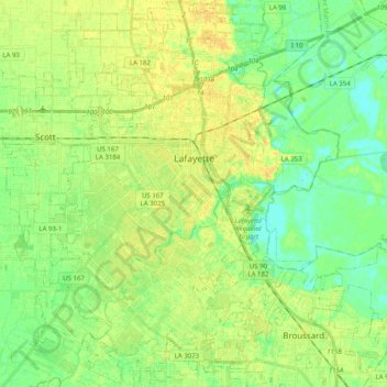
Name: Topografische Karte Lafayette, Höhe, Relief.
Durchschnittliche Höhe: 11 m
Minimale Höhe: -1 m
Maximale Höhe: 20 m
Lafayette is located at 30°13′N 92°2′W / 30.217°N 92.033°W / 30.217; -92.033 (30.2139, −92.0294) and has an elevation of 36 feet (11.0 m). According to the United States Census Bureau, the city has a total area of 49.2 square miles (127 km2), of which 49.1 square miles (127 km2) are land and 0.1 sq mi (0.26 km2) (0.19%) is covered by water.