
Topografische Karte Leadville
Interaktive Karte
Klicken Sie auf die Karte, um die Höhe anzuzeigen.
Über diese Karte
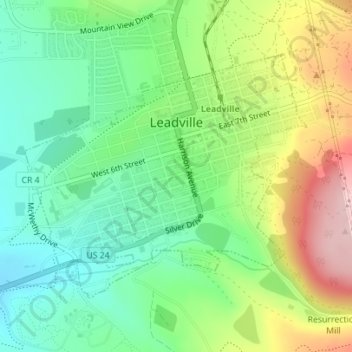
Name: Topografische Karte Leadville, Höhe, Relief.
Ort: Leadville, Lake County, Colorado, United States (39.23730 -106.30754 39.25598 -106.27958)
Durchschnittliche Höhe: 3’094 m
Minimale Höhe: 3’015 m
Maximale Höhe: 3’235 m
Leadville is the statutory city that is the county seat and only incorporated municipality in Lake County, Colorado, United States. The city population was 2,602 at the 2010 census and an estimated 2,762 in 2018. Leadville is situated at an elevation of 10,152 feet (3,094 m).