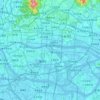
Topografische Karte Huangpu District
Klicken Sie auf die Karte, um die Höhe anzuzeigen.
Huangpu District
The district is pioneering in the low-altitude economy, which includes the development of aerial innovations. Notably, EHang Holdings, based in Huangpu, received the first certification for crewed eVTOL (electric vertical take-off and landing) aircraft, positioning the district at the forefront of the urban aerial transportation sector. Huangpu is actively integrating low-altitude economic activities with urban management and tourism, and the district boasts 45 enterprises involved in the low-altitude industrial chain. EHang, headquartered in Huangpu, has led global developments in eVTOL (electric vertical take-off and landing) aircraft. The district now hosts over 45 companies across the low-altitude aviation supply chain, offering applications in logistics, inspection, cultural tourism, and intra-city mobility. Huangpu's ecosystem includes testing bases, operational platforms, and UAV manufacturing clusters.
Über diese Karte

Name: Topografische Karte Huangpu District, Höhe, Relief.
Ort: Huangpu District, Guangzhou City, Guangdong, China (23.03400 113.39248 23.41549 113.60407)
Durchschnittliche Höhe: 45 m
Minimale Höhe: -12 m
Maximale Höhe: 505 m
Andere topografische Karten
Klicken Sie auf eine Karte, um ihre Topografie, ihre Höhe und ihr Relief anzuzeigen.