
Topografische Karte Cañon City
Interaktive Karte
Klicken Sie auf die Karte, um die Höhe anzuzeigen.
Über diese Karte
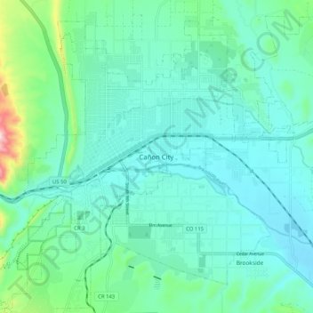
Name: Topografische Karte Cañon City, Höhe, Relief.
Ort: Cañon City, Fremont County, Colorado, 81212, United States (38.40236 -105.26249 38.48236 -105.18249)
Durchschnittliche Höhe: 1’670 m
Minimale Höhe: 1’589 m
Maximale Höhe: 2’045 m
The city's nickname, "the Climate Capital of Colorado", derives from the combination of unique geography and 5,300-foot (1,600 m) elevation protecting the city from harsh weather conditions. The average daily high temperature in January is 14 °F (7.8 °C) warmer in Cañon City than in Grand Junction, even though the elevation of Cañon City is higher.