
Spenden
Rüste dich für dein nächstes Abenteuer:
Als Amazon-Partner verdient diese Seite an qualifizierten Käufen, ohne dass Ihnen zusätzliche Kosten entstehen.
Topografische Karte Chandalar Shelf
Klicken Sie auf die Karte, um die Höhe anzuzeigen.
Spenden
Rüste dich für dein nächstes Abenteuer:
Als Amazon-Partner verdient diese Seite an qualifizierten Käufen, ohne dass Ihnen zusätzliche Kosten entstehen.
Über diese Karte
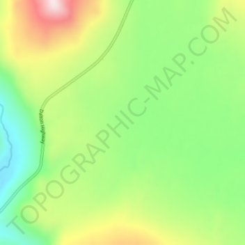
Name: Topografische Karte Chandalar Shelf, Höhe, Relief.
Ort: Chandalar Shelf, North Slope, Alaska, United States (68.04606 -149.60866 68.04616 -149.60856)
Durchschnittliche Höhe: 974 m
Minimale Höhe: 791 m
Maximale Höhe: 1’280 m
Spenden
Rüste dich für dein nächstes Abenteuer:
Als Amazon-Partner verdient diese Seite an qualifizierten Käufen, ohne dass Ihnen zusätzliche Kosten entstehen.
Andere topografische Karten
Klicken Sie auf eine Karte, um ihre Topografie, ihre Höhe und ihr Relief anzuzeigen.
Anaktuvuk Pass
United States > Alaska > North Slope
Anaktuvuk Pass is slightly north of the Brooks Range on the divide between the Anaktuvuk River and the John River, at an elevation of 2,200 ft (670 m). Anaktuvuk Pass is the last remaining settlement of the Nunamiut (People of the Land) Iñupiat Inuit in Alaska.
Durchschnittliche Höhe: 727 m
Spenden
Rüste dich für dein nächstes Abenteuer:
Als Amazon-Partner verdient diese Seite an qualifizierten Käufen, ohne dass Ihnen zusätzliche Kosten entstehen.