
Topografische Karte Glacier Point
Interaktive Karte
Klicken Sie auf die Karte, um die Höhe anzuzeigen.
Über diese Karte
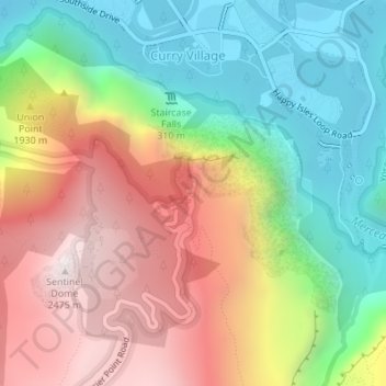
Name: Topografische Karte Glacier Point, Höhe, Relief.
Durchschnittliche Höhe: 1’775 m
Minimale Höhe: 1’208 m
Maximale Höhe: 2’479 m
Glacier Point is a viewpoint above Yosemite Valley in the U.S. state of California. It is located on the south wall of Yosemite Valley at an elevation of 7,214 feet (2,199 m), 3,200 feet (980 m) above Curry Village. The point offers a superb view of several of Yosemite National Park's well-known landmarks, including Yosemite Valley, Yosemite Falls, Half Dome, Vernal Fall, Nevada Fall, and Clouds Rest. Between 1872 and 1968, it was the site of the Yosemite Firefall.