

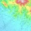
Topografische Karte Grosseto
Klicken Sie auf die Karte, um die Höhe anzuzeigen.
Grosseto
The Province of Grosseto completely occupies the southern end of Tuscany, and with a territorial area of 4,504 square kilometres (1,739 sq mi), it is the most extensive in the region and one of the least dense in population in Italy. The province is bordered to the northwest by the Province of Livorno, to the north by the Province of Pisa, to the northeast by the Province of Siena, and to the southeast by the Province of Viterbo in Lazio. To the south is the Tyrrhenian Sea, which includes the southern islands of the Tuscan archipelago, including Isola del Giglio and the smaller Giannutri islands and Formiche di Grosseto and Formica di Burano. The Arcipelago Toscano National Park spans both the provinces of Grosseto and Livorno, and includes the seven main islands of the Tuscan Archipelago: Elba, Isola del Giglio, Capraia, Montecristo, Pianosa, Giannutri, Gorgona, and some of the minor islands and rock outcrops. The highest point in the park is Mount Capanne, at 1,019 metres (3,343 ft) in elevation, on the island of Elba.
Über diese Karte

Name: Topografische Karte Grosseto, Höhe, Relief.
Ort: Grosseto, Tuscany, Italy (42.23762 10.70627 43.18914 11.82016)
Durchschnittliche Höhe: 197 m
Minimale Höhe: -5 m
Maximale Höhe: 1’677 m
Andere topografische Karten
Klicken Sie auf eine Karte, um ihre Topografie, ihre Höhe und ihr Relief anzuzeigen.

Lari
Lari is a walled mountaintop frazione, or hamlet, in the comune of Casciana Terme Lari, 60 kilometres (37 mi) southwest of Florence and 25 kilometres (16 mi) southeast of Pisa, in the Tuscany region of Italy. The municipal seat of its comune, Lari dates from at least the 9th century BC, a fact established by…
Durchschnittliche Höhe: 80 m







Mount Amiata
Italy > Tuscany > Siena > Abbadia San Salvatore
The region is included in the comuni of Abbadia San Salvatore, Arcidosso, Castel del Piano, Piancastagnaio, Santa Fiora and Seggiano, all located between 600 and 800 metres of altitude.
Durchschnittliche Höhe: 1’425 m


























Populonia
Italy > Tuscany > Livorno > Piombino
In geology, the "Tuscan metallogenic province" derived from volcanic intrusions into southern Etruria due to extension of the crust there (which also created a karst topography in western Italy) from the late Miocene to the Pleistocene. This process emplaced iron oxide deposits on Elba, pyrite in southern…
Durchschnittliche Höhe: 34 m








Montevettolini
Italy > Tuscany > Pistoia > Monsummano Terme > Pozzarello
Durchschnittliche Höhe: 127 m


