
Topografische Karte Navarre
Klicken Sie auf die Karte, um die Höhe anzuzeigen.
Navarre
Navarre is located at 30°24′04″N 86°51′47″W / 30.401°N 86.863°W / 30.401; -86.863Coordinates: 30°24′04″N 86°51′47″W / 30.401°N 86.863°W / 30.401; -86.863. It is located within a portion of the Florida Panhandle observing the Central Time Zone. Elevation is at an average of 10 feet (3.0 m).
Über diese Karte
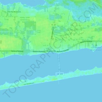
Name: Topografische Karte Navarre, Höhe, Relief.
Ort: Navarre, Santa Rosa County, Florida, 32566, United States (30.36198 -86.91008 30.44198 -86.83008)
Durchschnittliche Höhe: 4 m
Minimale Höhe: -4 m
Maximale Höhe: 25 m
Andere topografische Karten
Klicken Sie auf eine Karte, um ihre Topografie, ihre Höhe und ihr Relief anzuzeigen.