

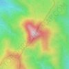
Topografische Karte Ulu Kelang
Klicken Sie auf die Karte, um die Höhe anzuzeigen.
Über diese Karte

Name: Topografische Karte Ulu Kelang, Höhe, Relief.
Durchschnittliche Höhe: 225 m
Minimale Höhe: 18 m
Maximale Höhe: 1’275 m
Andere topografische Karten
Klicken Sie auf eine Karte, um ihre Topografie, ihre Höhe und ihr Relief anzuzeigen.

Kampung Dato Mufti Shuib
Malaysia > Selangor > Ampang Jaya Municipal Council
Durchschnittliche Höhe: 118 m

Hulu Kelang
Malaysia > Selangor > Ampang Jaya Municipal Council
It has an area of 16.94 square kilometres, and is located northeast of Kuala Lumpur. The surface is relatively high; 500 metres above sea level, and the topography here is highland, lowland, or undulating land. As a result, it is a rain catchment area for the Klang River. Among the high locations are Bukit…
Durchschnittliche Höhe: 147 m



Kampung Indah Permai
Malaysia > Selangor > Ampang Jaya Municipal Council
Durchschnittliche Höhe: 137 m

Kampung Dato Mufti Shuib
Malaysia > Selangor > Ampang Jaya Municipal Council
Durchschnittliche Höhe: 118 m


Kampung Tasik Tambahan
Malaysia > Selangor > Ampang Jaya Municipal Council
Durchschnittliche Höhe: 118 m

Air Terjun Empangan Tasik Hijau
Malaysia > Selangor > Ampang Jaya Municipal Council
Durchschnittliche Höhe: 184 m

Kampung Sri Taman Baru
Malaysia > Selangor > Ampang Jaya Municipal Council
Durchschnittliche Höhe: 109 m


Kawasan Rekreasi AU2 Keramat
Malaysia > Selangor > Ampang Jaya Municipal Council
Durchschnittliche Höhe: 74 m

