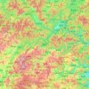
Topografische Karte Anji County
Klicken Sie auf die Karte, um die Höhe anzuzeigen.
Anji County
Anji County is located within the Yangtze Delta, where the Yangtze meets the East China Sea. The Tianmu Mountains run through southwest portion of the county, with the county's highest point, Longwang Mountain [zh], reaching 1,587.4 metres (5,208 ft) in elevation. Xitiao River, the county's longest river, flows from the southwest mountains northeast, before eventually emptying into Lake Tai.
Über diese Karte
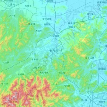
Name: Topografische Karte Anji County, Höhe, Relief.
Ort: Anji County, Huzhou, Zhejiang, China (30.37562 119.23240 30.87466 119.88466)
Durchschnittliche Höhe: 207 m
Minimale Höhe: -1 m
Maximale Höhe: 1’554 m
Andere topografische Karten
Klicken Sie auf eine Karte, um ihre Topografie, ihre Höhe und ihr Relief anzuzeigen.