
Topografische Karte Billington and Langho
Interaktive Karte
Klicken Sie auf die Karte, um die Höhe anzuzeigen.
Über diese Karte
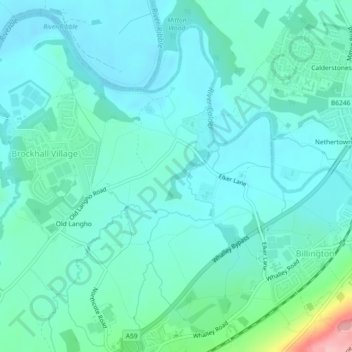
Name: Topografische Karte Billington and Langho, Höhe, Relief.
Durchschnittliche Höhe: 58 m
Minimale Höhe: 32 m
Maximale Höhe: 187 m
Andere topografische Karten
Klicken Sie auf eine Karte, um ihre Topografie, ihre Höhe und ihr Relief anzuzeigen.
Old Langho
United Kingdom > England > Lancashire > Ribble Valley > Brockhall Village
Old Langho, Billington and Langho, Brockhall Village, Ribble Valley, Lancashire, England, BB6 8AP, United Kingdom
Durchschnittliche Höhe: 74 m