
Topografische Karte Paint Lake Provincial Park
Interaktive Karte
Klicken Sie auf die Karte, um die Höhe anzuzeigen.
Über diese Karte
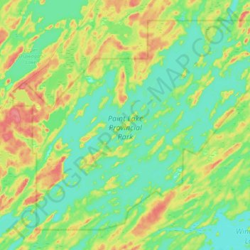
Name: Topografische Karte Paint Lake Provincial Park, Höhe, Relief.
Durchschnittliche Höhe: 198 m
Minimale Höhe: 179 m
Maximale Höhe: 239 m
Andere topografische Karten
Klicken Sie auf eine Karte, um ihre Topografie, ihre Höhe und ihr Relief anzuzeigen.
Halfway Lake
Canada > Manitoba > Local Government District of Mystery Lake
Halfway Lake, Local Government District of Mystery Lake, Manitoba, Canada
Durchschnittliche Höhe: 225 m
Setting Lake
Canada > Manitoba > Local Government District of Mystery Lake
Setting Lake, Local Government District of Mystery Lake, Manitoba, Canada
Durchschnittliche Höhe: 229 m