Geolokalisieren

Topografische Karte Howland Lake

Interaktive Karte

Klicken Sie auf die Karte, um die Höhe anzuzeigen.

Über diese Karte

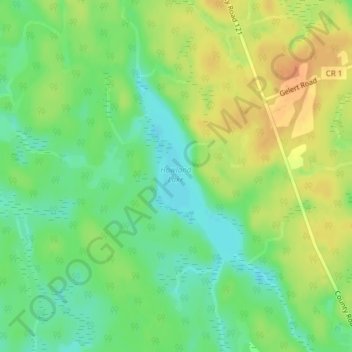
Name: Topografische Karte Howland Lake, Höhe, Relief.

Ort: Howland Lake, Minden Hills, Haliburton County, Central Ontario, Ontario, Canada (44.83306 -78.69544 44.84613 -78.68450)

Durchschnittliche Höhe: 317 m

Minimale Höhe: 299 m

Maximale Höhe: 336 m

Andere topografische Karten

Klicken Sie auf eine Karte, um ihre Topografie, ihre Höhe und ihr Relief anzuzeigen.

Irondale

Canada > Ontario > Haliburton County > Minden Hills

Irondale, Minden Hills, Haliburton County, Central Ontario, Ontario, K0M 1X0, Canada

Durchschnittliche Höhe: 331 m

Minden

Canada > Ontario > Haliburton County > Minden Hills

Minden, Minden Hills, Haliburton County, Central Ontario, Ontario, K0M 2K0, Canada

Durchschnittliche Höhe: 320 m

Gull Lake

Canada > Ontario > Haliburton County > Minden Hills

Gull Lake, Minden Hills, Haliburton County, Central Ontario, Ontario, Canada

Durchschnittliche Höhe: 281 m

Mountain Lake

Canada > Ontario > Haliburton County > Minden Hills

Mountain Lake, Minden Hills, Haliburton County, Central Ontario, Ontario, K0M 1J0, Canada

Durchschnittliche Höhe: 326 m

Bob Lake

Canada > Ontario > Haliburton County > Minden Hills

Bob Lake, Minden Hills, Haliburton County, Central Ontario, Ontario, Canada

Durchschnittliche Höhe: 319 m

Salerno Lake

Canada > Ontario > Haliburton County > Minden Hills

Salerno Lake, Minden Hills, Haliburton County, Central Ontario, Ontario, Canada

Durchschnittliche Höhe: 323 m

Twelve Mile Lake

Canada > Ontario > Haliburton County > Minden Hills

Twelve Mile Lake, Minden Hills, Haliburton County, Central Ontario, Ontario, K0M 1J0, Canada

Durchschnittliche Höhe: 324 m

Minden Lake

Canada > Ontario > Haliburton County > Minden Hills > Minden

Minden Lake, Minden, Minden Hills, Haliburton County, Central Ontario, Ontario, Canada

Durchschnittliche Höhe: 321 m