
Topografische Karte חורבות חלוצה
Interaktive Karte
Klicken Sie auf die Karte, um die Höhe anzuzeigen.
Über diese Karte
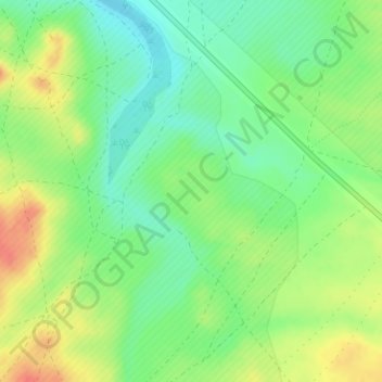
Name: Topografische Karte חורבות חלוצה, Höhe, Relief.
Durchschnittliche Höhe: 229 m
Minimale Höhe: 207 m
Maximale Höhe: 258 m
Andere topografische Karten
Klicken Sie auf eine Karte, um ihre Topografie, ihre Höhe und ihr Relief anzuzeigen.
Nahal Zin
Israel > South District > Ramat Negev Regional Council
Nahal Zin, Ramat Negev Regional Council, Beersheba Subdistrict, South District, Israel
Durchschnittliche Höhe: 711 m
Midreshet Ben-Gurion
Israel > South District > Ramat Negev Regional Council
Midreshet Ben-Gurion, Ramat Negev Regional Council, Beersheba Subdistrict, South District, 84900, Israel
Durchschnittliche Höhe: 449 m
Sde Boker
Israel > South District > Ramat Negev Regional Council
Sde Boker, Ramat Negev Regional Council, Beersheba Subdistrict, South District, Israel
Durchschnittliche Höhe: 481 m
Nitsana
Israel > South District > Ramat Negev Regional Council
Nitsana, Ramat Negev Regional Council, Beersheba Subdistrict, South District, Israel
Durchschnittliche Höhe: 236 m
Mt. Saharonim
Israel > South District > Ramat Negev Regional Council
Mt. Saharonim, Ramat Negev Regional Council, Beersheba Subdistrict, South District, Israel
Durchschnittliche Höhe: 453 m
Tlalim
Israel > South District > Ramat Negev Regional Council > Tlalim
Tlalim, Ramat Negev Regional Council, Beersheba Subdistrict, South District, 85545, Israel
Durchschnittliche Höhe: 364 m
Ramon
Israel > South District > Ramat Negev Regional Council
Ramon, Ramat Negev Regional Council, Beersheba Subdistrict, South District, Israel
Durchschnittliche Höhe: 947 m
Ezuz
Israel > South District > Ramat Negev Regional Council
Ezuz, Ramat Negev Regional Council, Beersheba Subdistrict, South District, Israel
Durchschnittliche Höhe: 414 m
Avdat National Park
Israel > South District > Ramat Negev Regional Council
Avdat National Park, שביל ישראל לאופניים, Ramat Negev Regional Council, South District, no, Israel
Durchschnittliche Höhe: 555 m