
Topografische Karte Belton
Klicken Sie auf die Karte, um die Höhe anzuzeigen.
Belton
Belton is located 60 miles (97 km) north of Austin, 137 miles (220 km) south of Dallas, and 184 miles (296 km) west of Houston. It is near the center of Bell County at 31°3′32″N 97°27′48″W / 31.05889°N 97.46333°W / 31.05889; -97.46333 (31.058904, -97.463382). It is at the point where the Blackland Prairie, characterized by level ground and deep fertile soil, and the Edwards Plateau, characterized by its many springs, hills, and steep canyons, meet. Its elevation is approximately 509 feet (155 m).
Über diese Karte
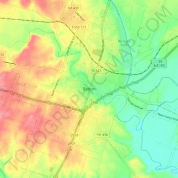
Name: Topografische Karte Belton, Höhe, Relief.
Ort: Belton, Bell County, Texas, 76513, United States (31.01601 -97.50445 31.09601 -97.42445)
Durchschnittliche Höhe: 176 m
Minimale Höhe: 134 m
Maximale Höhe: 223 m