Geolokalisieren

Topografische Karte Taliparamba

Klicken Sie auf die Karte, um die Höhe anzuzeigen.

Taliparamba

Taliparamba is located at 12°03′N 75°21′E / 12.05°N 75.35°E / 12.05; 75.35. It has an average elevation of 56 metres (184 ft) above sea level. The surrounding area (including the villages of Pattuvam, Pariyaram, Kuttiyeri, Karimbam, and Koonam) features lush green fields and low rolling hills. The Kuppam and Valapattanam rivers surround the town and the Arabian Sea is only 14 kilometres (8.7 mi) to the west of the city.

Wikipedia (CC-BY-SA 3.0)

Über diese Karte

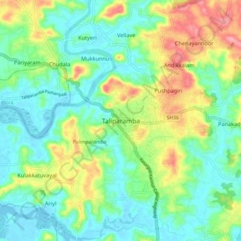
Name: Topografische Karte Taliparamba, Höhe, Relief.

Ort: Taliparamba, Kannur, Kerala, 670141, India (11.99735 75.32028 12.07735 75.40028)

Durchschnittliche Höhe: 35 m

Minimale Höhe: -2 m

Maximale Höhe: 110 m

Andere topografische Karten

Klicken Sie auf eine Karte, um ihre Topografie, ihre Höhe und ihr Relief anzuzeigen.

Naduvil

India > Kerala > Taliparamba > Karuvanchal

Durchschnittliche Höhe: 288 m

Payyavoor

India > Kerala > Taliparamba > Payyavoor

Durchschnittliche Höhe: 221 m

Chengalayi

India > Kerala > Taliparamba > Chengalai > Parripayi

Durchschnittliche Höhe: 60 m

Nediyenga

India > Kerala > Taliparamba > Sreekandapuram

Durchschnittliche Höhe: 98 m

Valapattanam

India > Kerala > Taliparamba

Durchschnittliche Höhe: 86 m

Peruvangur

India > Kerala > Taliparamba > Mayyil

Durchschnittliche Höhe: 28 m

Kanakakunnu

India > Kerala > Taliparamba > Paithalmala

Durchschnittliche Höhe: 631 m

Cheleri

India > Kerala > Taliparamba

Durchschnittliche Höhe: 11 m

Poovanchal

India > Kerala > Taliparamba > Karthikapuram

Durchschnittliche Höhe: 178 m

Maniyoor

India > Kerala > Taliparamba > Cheruvathala Motta

Durchschnittliche Höhe: 35 m

Chandanakampara

India > Kerala > Taliparamba > Chandanakampara

Durchschnittliche Höhe: 330 m

Kaithapram

India > Kerala > Taliparamba > Sreekandapuram

Durchschnittliche Höhe: 35 m

Irikkur

India > Kerala > Taliparamba

Durchschnittliche Höhe: 332 m

Therthally

India > Kerala > Taliparamba > Therthalli

Durchschnittliche Höhe: 113 m

Rüste dich für dein nächstes Abenteuer:

🚑Erste-Hilfe-Sets Outdoor - Kompakte Notfallversorgung für Wanderer und Kletterer
👕Merino-Base-Layer - Natürliche Temperaturregulierung für den Aufstieg
🧣Merinoschals - Kratzfreie Wärme für den Halsbereich
🍲Outdoor‑Geschirrsets - Leichte und robuste Sets für Essen unterwegs
📡GPS‑Handgeräte - Outdoor‑GPS‑Geräte zur Wegnavigation und Tracking

Als Amazon-Partner verdient diese Seite an qualifizierten Käufen, ohne dass Ihnen zusätzliche Kosten entstehen.