
Topografische Karte Cherokee
Interaktive Karte
Klicken Sie auf die Karte, um die Höhe anzuzeigen.
Über diese Karte
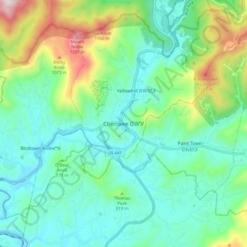
Name: Topografische Karte Cherokee, Höhe, Relief.
Durchschnittliche Höhe: 746 m
Minimale Höhe: 554 m
Maximale Höhe: 1’306 m
Cherokee and its surrounding Qualla Boundary is in the very mountainous Swain and Jackson counties. The highest elevation is 6,643-foot (2,025 m) Clingman's Dome at the border with Tennessee. Clingman's Dome is the highest point in the Great Smoky Mountains National Park. The Oconaluftee River flows through downtown Cherokee.