Geolokalisieren

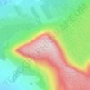
Topografische Karte Scurmore

Klicken Sie auf die Karte, um die Höhe anzuzeigen.

Über diese Karte

Name: Topografische Karte Scurmore, Höhe, Relief.

Ort: Scurmore, Castleconor West Electoral Division, Ballymote-Tubbercurry Municipal District, County Sligo, Connacht, Ireland (54.18675 -9.12775 54.20411 -9.10424)

Durchschnittliche Höhe: 13 m

Minimale Höhe: -1 m

Maximale Höhe: 59 m

Andere topografische Karten

Klicken Sie auf eine Karte, um ihre Topografie, ihre Höhe und ihr Relief anzuzeigen.

Rathcormack

Ireland > County Sligo

Durchschnittliche Höhe: 27 m

Benbulbin

Ireland > County Sligo

Durchschnittliche Höhe: 257 m

Geevagh

Ireland > County Sligo

Durchschnittliche Höhe: 92 m

Truskmore

Ireland > County Sligo

Durchschnittliche Höhe: 447 m

Drumcliff Round Tower

Ireland > County Sligo

Durchschnittliche Höhe: 10 m

Rosses Point

Ireland > County Sligo

Durchschnittliche Höhe: 4 m

Dooney Rock

Ireland > County Sligo

Durchschnittliche Höhe: 53 m

Beltra

Ireland > County Sligo

Durchschnittliche Höhe: 19 m

Coney Island

Ireland > County Sligo

Durchschnittliche Höhe: 1 m

Kesh

Ireland > County Sligo

Durchschnittliche Höhe: 122 m

Ballynacarrow

Ireland > County Sligo

Durchschnittliche Höhe: 72 m

Garavogue

Ireland > County Sligo

Durchschnittliche Höhe: 20 m

Castlebaldwin

Ireland > County Sligo

Durchschnittliche Höhe: 92 m

Chapel Street

Ireland > County Sligo

Durchschnittliche Höhe: 62 m

Kesh

Ireland > County Sligo

Durchschnittliche Höhe: 122 m

Cloonloo

Ireland > County Sligo

Durchschnittliche Höhe: 102 m

Geevagh

Ireland > County Sligo

Durchschnittliche Höhe: 92 m

Easky

Ireland > County Sligo

In Samuel Lewis's 1837 publication of A Topographical Dictionary of Ireland, Easky was described as having 6,124 inhabitants, of which 289 were in the village. Lewis noted that the village (made up of one long street) had petty sessions every fortnight and that Wednesday was market day. As well as other more…

Durchschnittliche Höhe: 17 m

Carrane Hill

Ireland > County Sligo

Durchschnittliche Höhe: 324 m

Rüste dich für dein nächstes Abenteuer:

⌚Sportuhren mit Barometer - Höhenmessung und Wettertrend direkt am Handgelenk
🧊Kleine Kühltaschen - Frischer Proviant für sommerliche Tagestouren
🧂Elektrolyt‑Getränke - Hydrierungsunterstützung für lange Anstrengungen
🧰Multitools & Messer - Vielseitige Werkzeuge für Outdoor‑Einsätze
🔋Solar-Powerbanks - Unabhängige Stromversorgung für GPS und Smartphones im Gelände

Als Amazon-Partner verdient diese Seite an qualifizierten Käufen, ohne dass Ihnen zusätzliche Kosten entstehen.