
Topografische Karte San Feliz de las Lavanderas
Interaktive Karte
Klicken Sie auf die Karte, um die Höhe anzuzeigen.
Über diese Karte
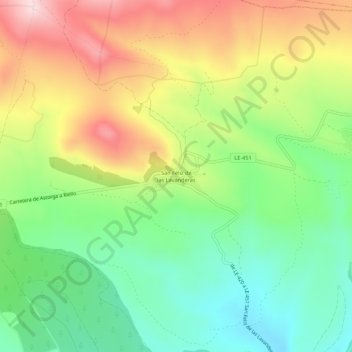
Name: Topografische Karte San Feliz de las Lavanderas, Höhe, Relief.
Durchschnittliche Höhe: 1’166 m
Minimale Höhe: 1’020 m
Maximale Höhe: 1’369 m
Andere topografische Karten
Klicken Sie auf eine Karte, um ihre Topografie, ihre Höhe und ihr Relief anzuzeigen.
Riofrío
España > Castilla y León > Quintana del Castillo > Riofrío
Riofrío, Quintana del Castillo, León, Castilla y León, 24285, España
Durchschnittliche Höhe: 981 m
Escuredo
España > Castilla y León > Quintana del Castillo > Escuredo
Escuredo, Quintana del Castillo, Tierra de Astorga, León, Castilla y León, 24397, España
Durchschnittliche Höhe: 1’151 m