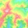
Topografische Karte Metauro
Klicken Sie auf die Karte, um die Höhe anzuzeigen.
Metauro
The name of the river in Latin is Metaurus or Mataurus. In Ancient Greek, the name of the river is Métauros, Μέταυρος which stems simply from the union of the two torrents: Meta, running from the Apennine pass Bocca Trabaria, at an elevation of 1,044 metres (3,425 ft), and Auro, flowing from Monte Maggiore, at an elevation of 1,384 metres (4,541 ft).
Über diese Karte

Name: Topografische Karte Metauro, Höhe, Relief.
Ort: Metauro, Marche, Italy (43.64251 12.29656 43.82887 13.05533)
Durchschnittliche Höhe: 313 m
Minimale Höhe: -1 m
Maximale Höhe: 1’661 m
Andere topografische Karten
Klicken Sie auf eine Karte, um ihre Topografie, ihre Höhe und ihr Relief anzuzeigen.


Castelletta I
Italy > Marche > Macerata > Civitanova Marche > Civitanova Alta
Durchschnittliche Höhe: 41 m