
Topografische Karte Clinton
Interaktive Karte
Klicken Sie auf die Karte, um die Höhe anzuzeigen.
Über diese Karte
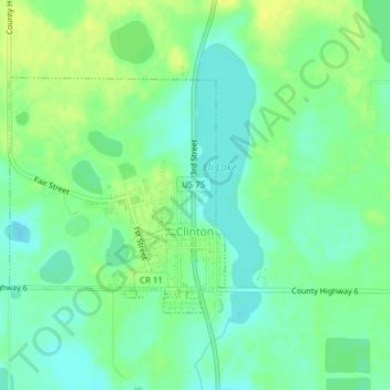
Name: Topografische Karte Clinton, Höhe, Relief.
Ort: Clinton, Big Stone County, Minnesota, 56225, United States (45.45458 -96.45204 45.47090 -96.43067)
Durchschnittliche Höhe: 352 m
Minimale Höhe: 343 m
Maximale Höhe: 363 m
Andere topografische Karten
Klicken Sie auf eine Karte, um ihre Topografie, ihre Höhe und ihr Relief anzuzeigen.
Johnson
United States > Minnesota > Big Stone County
Johnson, Big Stone County, Minnesota, United States
Durchschnittliche Höhe: 346 m
Ortonville
United States > Minnesota > Big Stone County
Ortonville, Big Stone County, Minnesota, 56278, United States
Durchschnittliche Höhe: 318 m
Odessa
United States > Minnesota > Big Stone County
Odessa, Big Stone County, Minnesota, United States
Durchschnittliche Höhe: 299 m
Barry
United States > Minnesota > Big Stone County
Barry, Big Stone County, Minnesota, 56210, United States
Durchschnittliche Höhe: 338 m
Correll
United States > Minnesota > Big Stone County
Correll, Big Stone County, Minnesota, United States
Durchschnittliche Höhe: 299 m
Beardsley
United States > Minnesota > Big Stone County
Beardsley, Big Stone County, Minnesota, United States
Durchschnittliche Höhe: 336 m
Graceville
United States > Minnesota > Big Stone County
Graceville, Big Stone County, Minnesota, 56240, United States
Durchschnittliche Höhe: 337 m