Geolokalisieren
👉 Easily get elevation data in JSON, GeoTIFF and KML formats using Elevation API
Vielen Dank für die Unterstützung dieser Website ❤️
Spenden

Topografische Karte Macreddin

Klicken Sie auf die Karte, um die Höhe anzuzeigen.

Macreddin

The elevation of Carysfort was too high and settlers soon moved south down the valley to Aughrim. In the eighteenth century there was still a fairground at the crossroads, with "riotous" two-day fairs held at Whitsun and All Saints. Michael Dwyer stayed in Macreddin when repairing to the Wicklow Mountains after the 1798 Rising. The 1835 commissioners' report described Carysfort as "a small village, containing a few houses of the humblest class", and concluded, "There is but a thinly-scattered population in the neighbourhood, and neither trade or commerce of any kind in the village, and there seems to be no occasion whatever for reviving the corporation."

Wikipedia (CC-BY-SA 3.0)

Über diese Karte

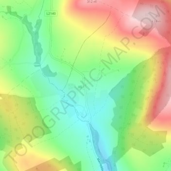
Name: Topografische Karte Macreddin, Höhe, Relief.

Ort: Macreddin, Aughrim ED, The Municipal District of Arklow, County Wicklow, Leinster, Y14 A362, Ireland (52.87464 -6.34073 52.89464 -6.32073)

Durchschnittliche Höhe: 224 m

Minimale Höhe: 108 m

Maximale Höhe: 374 m

👉 Easily get elevation data in JSON, GeoTIFF and KML formats using Elevation API
Vielen Dank für die Unterstützung dieser Website ❤️
Spenden

Rüste dich für dein nächstes Abenteuer:

Als Amazon-Partner verdient diese Seite an qualifizierten Käufen, ohne dass Ihnen zusätzliche Kosten entstehen.

Andere topografische Karten

Klicken Sie auf eine Karte, um ihre Topografie, ihre Höhe und ihr Relief anzuzeigen.

Wicklow

Ireland > County Wicklow

Durchschnittliche Höhe: 58 m

Lough Dan

Ireland > County Wicklow

Durchschnittliche Höhe: 309 m

Lough Tay

Ireland > County Wicklow

Durchschnittliche Höhe: 395 m

Sally Gap

Ireland > County Wicklow

Durchschnittliche Höhe: 512 m

Vielen Dank für die Unterstützung dieser Website ❤️
Spenden

Rüste dich für dein nächstes Abenteuer:

Als Amazon-Partner verdient diese Seite an qualifizierten Käufen, ohne dass Ihnen zusätzliche Kosten entstehen.

Baltinglass

Ireland > County Wicklow

A nineteenth-century explanation is found in Samuel Lewis' A Topographical Dictionary of Ireland, where he says that the name, "according to most antiquaries," comes from Baal-Tin-Glas, meaning the "pure fire of Baal," and that this suggests that the area was a centre for "druidical worship".

Durchschnittliche Höhe: 163 m

Ennereilly

Ireland > County Wicklow

Durchschnittliche Höhe: 10 m

Avondale

Ireland > County Wicklow

Durchschnittliche Höhe: 117 m

Kilpedder

Ireland > County Wicklow

Durchschnittliche Höhe: 99 m

Tomriland

Ireland > County Wicklow

Durchschnittliche Höhe: 204 m

Kindlestown Lower

Ireland > County Wicklow

Durchschnittliche Höhe: 58 m

Arklow

Ireland > County Wicklow

Durchschnittliche Höhe: 16 m

Donard

Ireland > County Wicklow

Durchschnittliche Höhe: 212 m

Ballylusk

Ireland > County Wicklow

Durchschnittliche Höhe: 249 m

Dunlavin

Ireland > County Wicklow

Durchschnittliche Höhe: 173 m

Ballinacooley

Ireland > County Wicklow

Durchschnittliche Höhe: 110 m

Newtown

Ireland > County Wicklow

Durchschnittliche Höhe: 104 m

Wicklow Mountains National Park

Ireland > County Wicklow

Durchschnittliche Höhe: 322 m

Ashford

Ireland > County Wicklow

Durchschnittliche Höhe: 49 m

Toberpatrick

Ireland > County Wicklow

Durchschnittliche Höhe: 157 m

Johnstown Lower

Ireland > County Wicklow

Durchschnittliche Höhe: 64 m

Curtlestown Upper

Ireland > County Wicklow

Durchschnittliche Höhe: 343 m

Avoca

Ireland > County Wicklow

Durchschnittliche Höhe: 117 m

Blessington

Ireland > County Wicklow

Durchschnittliche Höhe: 204 m

Knockananna

Ireland > County Wicklow

Durchschnittliche Höhe: 189 m

Carnew

Ireland > County Wicklow

Durchschnittliche Höhe: 94 m

Springfarm

Ireland > County Wicklow

Durchschnittliche Höhe: 130 m

Newry

Ireland > County Wicklow

Durchschnittliche Höhe: 134 m

Turlough Hill Reservoir

Ireland > County Wicklow

Durchschnittliche Höhe: 556 m

Vielen Dank für die Unterstützung dieser Website ❤️
Spenden

Kilbaylet Lower

Ireland > County Wicklow

Durchschnittliche Höhe: 257 m

Knocksink Wood

Ireland > County Wicklow

Durchschnittliche Höhe: 175 m

Tulfarris

Ireland > County Wicklow

Durchschnittliche Höhe: 196 m

Deerpark

Ireland > County Wicklow

Durchschnittliche Höhe: 313 m

Kilcarra West

Ireland > County Wicklow

Durchschnittliche Höhe: 98 m

Tonygarrow

Ireland > County Wicklow

Durchschnittliche Höhe: 350 m

Aghowle

Ireland > County Wicklow

Durchschnittliche Höhe: 154 m

Aghavannagh

Ireland > County Wicklow > Ballygobban Bridge

Durchschnittliche Höhe: 266 m

Ballycumber South

Ireland > County Wicklow

Durchschnittliche Höhe: 271 m

Ballyfolan

Ireland > County Wicklow

Durchschnittliche Höhe: 322 m

Tinahely

Ireland > County Wicklow

Durchschnittliche Höhe: 127 m

Glenealy

Ireland > County Wicklow

Durchschnittliche Höhe: 113 m

Bray

Ireland > County Wicklow

Durchschnittliche Höhe: 42 m

Rathdrum

Ireland > County Wicklow

Durchschnittliche Höhe: 136 m

Laragh

Ireland > County Wicklow

Durchschnittliche Höhe: 215 m

Carrick

Ireland > County Wicklow

Durchschnittliche Höhe: 163 m

Lower Lough Bray

Ireland > County Wicklow

Durchschnittliche Höhe: 455 m

Wicklow Mountains National Park

Ireland > County Wicklow

Durchschnittliche Höhe: 322 m

Wicklow Mountains National Park

Ireland > County Wicklow

Durchschnittliche Höhe: 322 m

Knockananna

Ireland > County Wicklow

Durchschnittliche Höhe: 189 m

Arklow

Ireland > County Wicklow

Durchschnittliche Höhe: 14 m

Kilquade

Ireland > County Wicklow

Durchschnittliche Höhe: 61 m

Roundwood

Ireland > County Wicklow

Durchschnittliche Höhe: 227 m

Glencree

Ireland > County Wicklow

Durchschnittliche Höhe: 358 m

Shankill

Ireland > County Wicklow

Durchschnittliche Höhe: 438 m

Curtlestown Lower

Ireland > County Wicklow

Durchschnittliche Höhe: 241 m

Aughrim

Ireland > County Wicklow

Durchschnittliche Höhe: 123 m

Burgage

Ireland > County Wicklow

Durchschnittliche Höhe: 211 m

Stagonil Parish

Ireland > County Wicklow

Durchschnittliche Höhe: 365 m

Enniskerry

Ireland > County Wicklow

Durchschnittliche Höhe: 111 m

Cleevaun Lough

Ireland > County Wicklow

Durchschnittliche Höhe: 641 m

Bollarney Murragh

Ireland > County Wicklow

Durchschnittliche Höhe: 9 m

Tomnafinnoge Wood

Ireland > County Wicklow

Durchschnittliche Höhe: 106 m

Newtown Mount Kennedy

Ireland > County Wicklow

Durchschnittliche Höhe: 102 m

Upper Lough Bray

Ireland > County Wicklow

Durchschnittliche Höhe: 496 m

Ballinaclogh

Ireland > County Wicklow

Durchschnittliche Höhe: 108 m

Ballinacor East

Ireland > County Wicklow

Durchschnittliche Höhe: 65 m

Laragh

Ireland > County Wicklow

Durchschnittliche Höhe: 215 m

Arklow

Ireland > County Wicklow

Durchschnittliche Höhe: 16 m

Ballinasilloge

Ireland > County Wicklow

Durchschnittliche Höhe: 257 m

Sally Gap

Ireland > County Wicklow

Durchschnittliche Höhe: 512 m

Ballysmuttan Upper

Ireland > County Wicklow

Durchschnittliche Höhe: 276 m

Blessington

Ireland > County Wicklow

Durchschnittliche Höhe: 204 m

Roundwood

Ireland > County Wicklow

Durchschnittliche Höhe: 242 m

Bray

Ireland > County Wicklow

Durchschnittliche Höhe: 42 m

Kilcoole

Ireland > County Wicklow

Durchschnittliche Höhe: 29 m

Tinahely

Ireland > County Wicklow

Durchschnittliche Höhe: 128 m

Lugduff

Ireland > County Wicklow

Durchschnittliche Höhe: 111 m

Kilruddery Deerpark

Ireland > County Wicklow

Durchschnittliche Höhe: 132 m

Togher Beg

Ireland > County Wicklow

Durchschnittliche Höhe: 239 m

Knocksink

Ireland > County Wicklow

Durchschnittliche Höhe: 122 m

Castlekevin

Ireland > County Wicklow

Durchschnittliche Höhe: 214 m

Newcastle

Ireland > County Wicklow

Durchschnittliche Höhe: 28 m

The Rocks at Priestnewtown

Ireland > County Wicklow

Durchschnittliche Höhe: 44 m

Arklow

Ireland > County Wicklow

Durchschnittliche Höhe: 16 m

Wicklow

Ireland > County Wicklow

Durchschnittliche Höhe: 58 m

Arklow

Ireland > County Wicklow

Durchschnittliche Höhe: 16 m

Blessington

Ireland > County Wicklow

Durchschnittliche Höhe: 204 m

Tiknock

Ireland > County Wicklow

Durchschnittliche Höhe: 15 m

Rathmichael (Bray) ED

Ireland > County Wicklow

Durchschnittliche Höhe: 36 m

Glendalough Round Tower

Ireland > County Wicklow

Durchschnittliche Höhe: 265 m

Dunbur Head

Ireland > County Wicklow

Durchschnittliche Höhe: 26 m

Garrymore Lower

Ireland > County Wicklow

Durchschnittliche Höhe: 139 m

Tigroney West

Ireland > County Wicklow

Durchschnittliche Höhe: 121 m

Connary Lower

Ireland > County Wicklow

Durchschnittliche Höhe: 118 m

Milltown North

Ireland > County Wicklow

Durchschnittliche Höhe: 35 m

Ballymerrigan

Ireland > County Wicklow

Durchschnittliche Höhe: 65 m

Slate

Ireland > County Wicklow

Durchschnittliche Höhe: 48 m

Rüste dich für dein nächstes Abenteuer:

🍽️Campinggeschirr-Sets - Leichtes und stapelbares Geschirr für Unterwegs
🧣Multifunktionstücher - Vielseitiger Schutz für Hals und Kopf beim Wandern
👒Sonnen‑Caps - Leichte Caps mit UV‑Schutz für Outdoor
🧤Outdoor‑Handschuhe - Schützende Handschuhe für Berg‑ und Kälteeinsätze
🚑Erste-Hilfe-Sets Outdoor - Kompakte Notfallversorgung für Wanderer und Kletterer

Als Amazon-Partner verdient diese Seite an qualifizierten Käufen, ohne dass Ihnen zusätzliche Kosten entstehen.