
Topografische Karte Frost
Interaktive Karte
Klicken Sie auf die Karte, um die Höhe anzuzeigen.
Über diese Karte
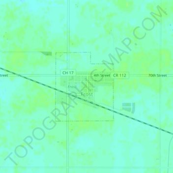
Name: Topografische Karte Frost, Höhe, Relief.
Ort: Frost, Faribault County, Minnesota, United States (43.57952 -93.93080 43.59028 -93.91829)
Durchschnittliche Höhe: 342 m
Minimale Höhe: 337 m
Maximale Höhe: 346 m
Andere topografische Karten
Klicken Sie auf eine Karte, um ihre Topografie, ihre Höhe und ihr Relief anzuzeigen.
Bricelyn
United States > Minnesota > Faribault County
Bricelyn, Faribault County, Minnesota, United States
Durchschnittliche Höhe: 357 m
Huntley
United States > Minnesota > Faribault County
Huntley, Faribault County, Minnesota, 56047, United States
Durchschnittliche Höhe: 333 m
Easton
United States > Minnesota > Faribault County
Easton, Faribault County, Minnesota, 56025, United States
Durchschnittliche Höhe: 321 m
Winnebago
United States > Minnesota > Faribault County
Winnebago, Faribault County, Minnesota, United States
Durchschnittliche Höhe: 333 m
Blue Earth
United States > Minnesota > Faribault County
Blue Earth, Faribault County, Minnesota, 56013, United States
Durchschnittliche Höhe: 329 m
Elmore
United States > Minnesota > Faribault County
Elmore, Faribault County, Minnesota, United States
Durchschnittliche Höhe: 341 m
Delavan
United States > Minnesota > Faribault County
Delavan, Faribault County, Minnesota, United States
Durchschnittliche Höhe: 325 m
Wells
United States > Minnesota > Faribault County
Wells, Faribault County, Minnesota, United States
Durchschnittliche Höhe: 353 m
Kiester
United States > Minnesota > Faribault County
Kiester, Faribault County, Minnesota, 56051, United States
Durchschnittliche Höhe: 377 m
Walters
United States > Minnesota > Faribault County
Walters, Faribault County, Minnesota, United States
Durchschnittliche Höhe: 376 m
Minnesota Lake
United States > Minnesota > Faribault County
Minnesota Lake, Faribault County, Minnesota, 56068, United States
Durchschnittliche Höhe: 318 m