

Topografische Karte Cesi
Klicken Sie auf die Karte, um die Höhe anzuzeigen.
Cesi
Cesi is a frazione of the Italian comune of Terni, in the province of Terni, southern Umbria, Italy. The small borgo, which retains its late-medieval aspect, set among olive groves, lies "stretched out lengthwise along a narrow contour on the slopes of M. Torre Maggiore," about 18 km north of Terni at an altitude of 437 m, one of the southernmost peaks of the Monti Martani. As of 2001 there were 682 residents.
Über diese Karte
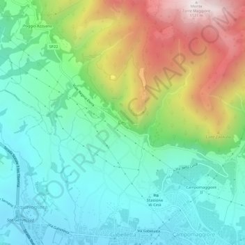
Name: Topografische Karte Cesi, Höhe, Relief.
Ort: Cesi, Terni, Umbria, 05100, Italy (42.58878 12.56650 42.62878 12.60650)
Durchschnittliche Höhe: 447 m
Minimale Höhe: 139 m
Maximale Höhe: 1’114 m