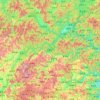
Topografische Karte Fuyang
Klicken Sie auf die Karte, um die Höhe anzuzeigen.
Fuyang
Located in northwestern Zhejiang province, in 1994 Fuyang was administratively merged into Hangzhou. The city has several highways including the G320 national road, Hangxijing, as well as highways 05, 23, 19 and 14. Fuyang is 51 kilometres (32 mi) from Hangzhou and convenient transport makes it possible to reach Hangzhou Train Station and Hangzhou Xiaoshan International Airport within one hour. In 2012, 45 natural disasters occurred in Fuyang, the majority not serious, although eight people died in October. To the southeast of the city, mountains cover a total area of 309.1 square kilometres (119.3 sq mi), accounting for the 16.9% of the city and 22.3% of the total mountain area. The elevation in this area exceeds 500 metres (1,640 ft) while the relative height is more than 400 metres (1,312 ft).
Über diese Karte
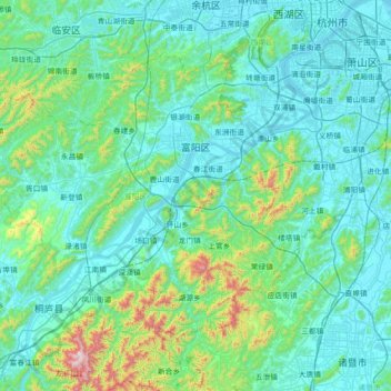
Name: Topografische Karte Fuyang, Höhe, Relief.
Ort: Fuyang, Hangzhou City, Zhejiang, China (29.74643 119.43074 30.20009 120.14388)
Durchschnittliche Höhe: 154 m
Minimale Höhe: -1 m
Maximale Höhe: 1’226 m
Andere topografische Karten
Klicken Sie auf eine Karte, um ihre Topografie, ihre Höhe und ihr Relief anzuzeigen.