

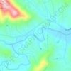
Topografische Karte Edneyville
Klicken Sie auf die Karte, um die Höhe anzuzeigen.
Edneyville
Edneyville is in northeastern Henderson County at an elevation of 2,246 feet (685 m) above sea level. The Eastern Continental Divide runs through the center of the CDP; the eastern side of the community drains via Reedypatch Creek to the Broad River, which flows through the Congaree and Santee River systems to the Atlantic Ocean, while the western side of the community drains to Clear Creek, which flows via Mud Creek to the French Broad River, then the Tennessee River, and finally the Mississippi River to the Gulf of Mexico.
Über diese Karte
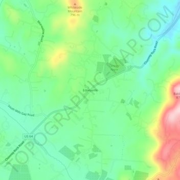
Name: Topografische Karte Edneyville, Höhe, Relief.
Ort: Edneyville, Henderson County, North Carolina, United States (35.37401 -82.36095 35.41401 -82.32095)
Durchschnittliche Höhe: 689 m
Minimale Höhe: 604 m
Maximale Höhe: 869 m
Andere topografische Karten
Klicken Sie auf eine Karte, um ihre Topografie, ihre Höhe und ihr Relief anzuzeigen.
Etowah
United States > North Carolina > Henderson County
Etowah has an altitude of 2,101 feet (640 m).
Durchschnittliche Höhe: 652 m
Hendersonville Reservoir
United States > North Carolina > Henderson County
Durchschnittliche Höhe: 855 m

Mills River
United States > North Carolina > Henderson County > Mills River
Durchschnittliche Höhe: 686 m