

Topografische Karte Garze
Klicken Sie auf die Karte, um die Höhe anzuzeigen.
Garze
Due to its elevation, Garzê County has a monsoon-influenced humid continental climate (Köppen Dwb) and subarctic climate, with cold but very dry winters, and warm summers with frequent rain. The monthly 24-hour average temperature ranges from −3.9 °C (25.0 °F) in January to 14.2 °C (57.6 °F) in July, while the annual mean is 5.93 °C (42.7 °F). Over two-thirds of the annual precipitation of 646 mm (25.4 in) occurs from June thru September. With monthly percent possible sunshine ranging from 49% in July to 74% in November and December, the county seat receives abundant, outside of summer, sunshine, totalling 2,620 hours annually. The diurnal temperature variation is large, averaging 14.5 °C (26.1 °F) annually.
Über diese Karte
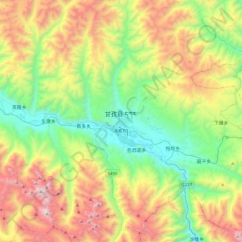
Name: Topografische Karte Garze, Höhe, Relief.
Ort: Garze, Garzê County, Kardze, Sichuan, 626700, China (31.46445 99.83086 31.78445 100.15086)
Durchschnittliche Höhe: 4’172 m
Minimale Höhe: 3’297 m
Maximale Höhe: 5’669 m