Topografische Karte Mhasla
Klicken Sie auf die Karte, um die Höhe anzuzeigen.
Über diese Karte

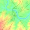
Name: Topografische Karte Mhasla, Höhe, Relief.
Ort: Mhasla, Raigad, Maharashtra, 402105, India (17.98016 72.99780 18.24823 73.28801)
Durchschnittliche Höhe: 126 m
Minimale Höhe: -2 m
Maximale Höhe: 501 m
Andere topografische Karten
Klicken Sie auf eine Karte, um ihre Topografie, ihre Höhe und ihr Relief anzuzeigen.
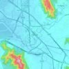
Panvel
India > Maharashtra > Panvel > Panvel
Matheran is a hill station and a municipal council in the Raigad district in the Indian state of Maharashtra. It is a hill station in Karjat Tahsil and is also the smallest hill station in India. It is located on the Western Ghats range at an elevation of around 800 m (2,625 feet) above sea level. It is…
Durchschnittliche Höhe: 75 m
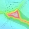
Ajinkyatara Fort
India > Maharashtra > Satara > Satara
Ajinkyatara Fort, also known as the "Fort of the Sapta-Rishi," is a historical hill fort located on Ajinkyatara Mountain, one of the seven mountains surrounding the city of Satara in the Sahyadri Mountains of Maharashtra, India. Situated at an altitude of 3,300 feet, the fort overlooks Satara City and is…
Durchschnittliche Höhe: 764 m


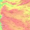
Maharashtra
Maharashtra is the third largest state by area in India. The Western Ghats better known as Sahyadri, are a hilly range running parallel to the coast, at an average elevation of 1,200 metres (4,000 ft). Kalsubai, a peak in the Sahyadris, near Nashik city is the highest elevated point in Maharashtra. To the west…
Durchschnittliche Höhe: 478 m

Devagiri Fort
India > Maharashtra > Chhatrapati Sambhajinagar > Daulatabad
Durchschnittliche Höhe: 606 m
Amravati
India > Maharashtra > Amravati
Amravati is located at 20°56′N 77°45′E / 20.93°N 77.75°E / 20.93; 77.75. It has an average elevation of 343 meters (1125 feet). It lies 156 km (97 mi) west of Nagpur and serves as the administrative centre of Amravati District and of Amravati Division. The city is located near the passes…
Durchschnittliche Höhe: 345 m



Malegaon
India > Maharashtra > Malegaon Taluka
Malegaon(previously Maligaon) is at the confluence of the Girna and Mosam (previously Moosy) rivers, at elevation of 438 metres (1437 feet) at 18°25′N 77°32′E / 18.42°N 77.53°E / 18.42; 77.53.
Durchschnittliche Höhe: 463 m
Navi Mumbai
India > Maharashtra > Thane > Navi Mumbai
Navi Mumbai (Marathi pronunciation: , also known by its former name New Bombay), is a planned city off the west coast of the Indian state of Maharashtra in Konkan division. The city is divided into two parts, North Navi Mumbai and South Navi Mumbai, for the individual development of Panvel Mega City, which…
Durchschnittliche Höhe: 30 m


Akluj
India > Maharashtra > Malshiras
Akluj is in Malshiras tehsil and is 120 km (75 mi) away from Solapur city. It is located on the right bank of Nira River. The elevation of Akluj is 551 m (1,808 ft). The latitude 17.9000 and longitude 75.0333. The altitude in feet 1581 Lat (DMS) north 17° 53' 60 N Long (DMS) east 75° 1' 60E altitude (meters)…
Durchschnittliche Höhe: 491 m


Pench (Indira Priyadarsini) National Park/Tiger Reserve
India > Maharashtra > Ramtek Taluka
Durchschnittliche Höhe: 485 m


Kalsubai Harishchandragad Wildlife Sanctuary
India > Maharashtra > Akola
Durchschnittliche Höhe: 654 m





Dombivli
India > Maharashtra > Kalyan Subdistrict > Kalyan-Dombivli
Dombivli is located at 19°13′06″N 73°05′12″E / 19.218433°N 73.086718°E / 19.218433; 73.086718. It has an average elevation of 13.534 meters (44.403 feet). The land here is rough and rocky by nature. The Ulhas river flows from its north.
Durchschnittliche Höhe: 11 m


Mumbai
Mumbai lies at the mouth of the Ulhas River on the western coast of India, in the coastal region known as the Konkan. It sits on Salsette Island (Sashti Island), which it partially shares with the Thane district. Mumbai is bounded by the Arabian Sea to the west. Many parts of the city lie just above sea level,…
Durchschnittliche Höhe: 13 m

Alibag
India > Maharashtra > Alibag Taluka
Alibag is located about 120 km south of Mumbai, at 18°38′29″N 72°52′20″E / 18.64139°N 72.87222°E / 18.64139; 72.87222. The average elevation is 0 metres (0 feet).The District Government offices are located along the sea coast road. Alibag is the center place of Raigad District.
Durchschnittliche Höhe: 12 m

Pimpri-Chinchwad
India > Maharashtra > Haveli Subdistrict
Pimpri-Chinchwad also known as "PCMC", is a city in the Indian state of Maharashtra. The city is about 15 km (9.3 mi) northwest of the historic city of Pune, at an altitude of 590 m (1,940 ft) above sea level. It is the fifth largest city in Maharashtra and the nineteenth largest city in India and the…
Durchschnittliche Höhe: 605 m





Coastal & Marine Biodiversity Centre
India > Maharashtra > Thane Subdistrict > Navi Mumbai
Durchschnittliche Höhe: 4 m

Kalasubai peak
India > Maharashtra > Akola > Karanda
Kalsubai is a mountain in the Western Ghats, located in the Indian state of Maharashtra. Kalsubai is the highest peak in Maharashtra and is located in Ahilyanagar district in Akole Taluka. Its summit, situated at an elevation of 1,646 metres (5,400 ft), is the highest point in Maharashtra and is known as the…
Durchschnittliche Höhe: 1’210 m

Lohgad
India > Maharashtra > Mawal Subdistrict > Dudhivare
Lohagad is one of the many hill forts of Maharashtra state in India. Situated close to the hill station Lonavala and 52 km (32 mi) northwest of Pune, Lohagad rises to an elevation of 1,033 m (3,389 ft) above sea level. The fort is connected to the neighboring Visapur fort by a small range. The fort was under…
Durchschnittliche Höhe: 797 m






Chhatrapati Sambhajinagar
India > Maharashtra > Chhatrapati Sambhajinagar
Durchschnittliche Höhe: 618 m
Parbhani
India > Maharashtra > Parbhani
Parbhani is located at 19°16′N 76°47′E / 19.27°N 76.78°E / 19.27; 76.78. It has an average elevation of 347 metres.
Durchschnittliche Höhe: 411 m
Solapur
India > Maharashtra > Solapur North
Solapur is located at 17°41′N 75°55′E / 17.68°N 75.92°E / 17.68; 75.92. It has an average elevation of 458 metres (1502 feet). It is bordered by Ahmednagar district on the north; Osmanabad district on the north and northeast.
Durchschnittliche Höhe: 469 m
Mahad
India > Maharashtra > Mahad Taluka
Several disasters like floods and landslides have continuously devastated markets and old houses, specifically classic Konkani-styled architecture, causing great loss of life. This is primarily due to lower elevation of the city compared to surrounding areas and being surrounded by rivers on all sides, making…
Durchschnittliche Höhe: 75 m