
Topografische Karte Pompano Beach
Interaktive Karte
Klicken Sie auf die Karte, um die Höhe anzuzeigen.
Über diese Karte
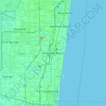
Name: Topografische Karte Pompano Beach, Höhe, Relief.
Ort: Pompano Beach, Broward County, Florida, 33060, United States (26.07786 -80.28477 26.39786 -79.96477)
Durchschnittliche Höhe: 4 m
Minimale Höhe: -4 m
Maximale Höhe: 44 m
Andere topografische Karten
Klicken Sie auf eine Karte, um ihre Topografie, ihre Höhe und ihr Relief anzuzeigen.
Pompano Beach Highlands
United States > Florida > Broward County > Pompano Beach
Pompano Beach Highlands, Pompano Beach, Broward County, Florida, 33064, United States
Durchschnittliche Höhe: 7 m
Santa Barbara Shores
United States > Florida > Broward County > Pompano Beach
Santa Barbara Shores, Pompano Beach, Broward County, Florida, 33062, United States
Durchschnittliche Höhe: 5 m
Kendall Green
United States > Florida > Broward County > Pompano Beach
Kendall Green, Pompano Beach, Broward County, Florida, 33064, United States
Durchschnittliche Höhe: 7 m
Pompano Isles
United States > Florida > Broward County > Pompano Beach
Pompano Isles, Pompano Beach, Broward County, Florida, 33062, United States
Durchschnittliche Höhe: 5 m
Cypress Harbor
United States > Florida > Broward County > Pompano Beach
Cypress Harbor, Pompano Beach, Broward County, Florida, 33060, United States
Durchschnittliche Höhe: 7 m
North Pompano Beach
United States > Florida > Broward County > Pompano Beach
North Pompano Beach, Pompano Beach, Broward County, Florida, 33064, United States
Durchschnittliche Höhe: 7 m