

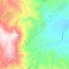
Topografische Karte Cromberg
Klicken Sie auf die Karte, um die Höhe anzuzeigen.
Über diese Karte

Name: Topografische Karte Cromberg, Höhe, Relief.
Ort: Cromberg, Plumas County, California, United States (39.84522 -120.73647 39.90013 -120.63147)
Durchschnittliche Höhe: 1’591 m
Minimale Höhe: 1’242 m
Maximale Höhe: 2’201 m
Andere topografische Karten
Klicken Sie auf eine Karte, um ihre Topografie, ihre Höhe und ihr Relief anzuzeigen.

Quincy
United States > California > Plumas County
Quincy has a Mediterranean climate (Köppen Csb) though its inland location and altitude makes it more continental and wetter than usual for this type, with very heavy snowfalls sometimes occurring in winter – the record being 133 inches (337.8 cm) in the very wet January 1916. Although summer days are hot…
Durchschnittliche Höhe: 1’274 m


East Quincy
United States > California > Plumas County
East-Quincy has a Mediterranean climate (Köppen Csb) though its inland location and altitude makes it more continental and wetter than usual for this type, with very heavy snowfalls sometimes occurring in winter – the record being 133 inches (337.8 cm) in the very wet January 1916. Although summer days are…
Durchschnittliche Höhe: 1’119 m


