

Topografische Karte Luannan County
Klicken Sie auf die Karte, um die Höhe anzuzeigen.
Luannan County
Luannan County spans an area of 1,482.6 square kilometres (572.4 sq mi). It has a coastline of 29.63 kilometres (18.41 mi), alongside the Bohai Bay. The Luan River runs through the county. The county's elevation is relatively flat, as it is part of an alluvial plain. However, it is higher in the northern portions.
Über diese Karte
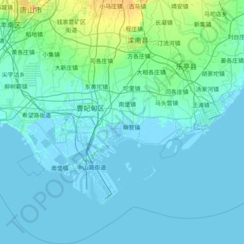
Name: Topografische Karte Luannan County, Höhe, Relief.
Ort: Luannan County, Tangshan City, Hebei, China (38.77375 118.02388 39.66148 118.85548)
Durchschnittliche Höhe: 5 m
Minimale Höhe: -4 m
Maximale Höhe: 76 m